You are here: Home > Network List > US - United States National Seismic Network Stations List
> Station HAWA Hanford, Washington, USA > Earthquake Result Viewer
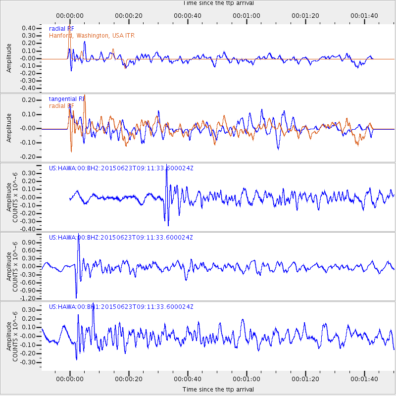
HAWA Hanford, Washington, USA - Earthquake Result Viewer
*The percent match for this event was below the threshold and hence no stack was calculated.
| Earthquake location: |
Tonga Islands |
| Earthquake latitude/longitude: |
-19.7/-175.2 |
| Earthquake time(UTC): |
2015/06/23 (174) 08:59:54 GMT |
| Earthquake Depth: |
124 km |
| Earthquake Magnitude: |
5.6 MB |
| Earthquake Catalog/Contributor: |
NEIC PDE/NEIC ALERT |
|
| Network: |
US United States National Seismic Network |
| Station: |
HAWA Hanford, Washington, USA |
| Lat/Lon: |
46.39 N/119.53 W |
| Elevation: |
364 m |
|
| Distance: |
82.7 deg |
| Az: |
35.187 deg |
| Baz: |
231.686 deg |
| Ray Param: |
$rayparam |
*The percent match for this event was below the threshold and hence was not used in the summary stack. |
|
| Radial Match: |
60.299614 % |
| Radial Bump: |
400 |
| Transverse Match: |
54.683327 % |
| Transverse Bump: |
400 |
| SOD ConfigId: |
976571 |
| Insert Time: |
2015-07-07 09:11:02.268 +0000 |
| GWidth: |
2.5 |
| Max Bumps: |
400 |
| Tol: |
0.001 |
|
Signal To Noise
| Channel | StoN | STA | LTA |
| US:HAWA:00:BHZ:20150623T09:11:33.600024Z | 6.451802 | 4.6976862E-7 | 7.281201E-8 |
| US:HAWA:00:BH1:20150623T09:11:33.600024Z | 1.5289475 | 1.1544885E-7 | 7.550871E-8 |
| US:HAWA:00:BH2:20150623T09:11:33.600024Z | 4.4154096 | 1.5059265E-7 | 3.4106154E-8 |
| Arrivals |
| Ps | |
| PpPs | |
| PsPs/PpSs | |


