LSA Tibet, China - Earthquake Result Viewer
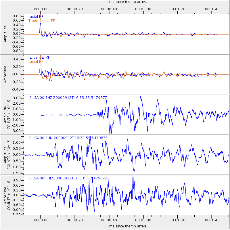
Earthquake location: Southwest Of Sumatra, Indonesia
Earthquake latitude/longitude: -5.4/101.8
Earthquake time(UTC): 2000/09/12 (256) 16:27:24 GMT
Earthquake Depth: 33 km
Earthquake Magnitude: 5.7 MB, 6.1 MS, 6.0 MW, 5.9 MW
Earthquake Catalog/Contributor: WHDF/NEIC
Network: IC New China Digital Seismograph Network
Station: LSA Tibet, China
Lat/Lon: 29.70 N/91.15 E
Elevation: 3789 m
Distance: 36.4 deg
Az: 344.246 deg
Baz: 161.901 deg
Ray Param: 0.07663671
Estimated Moho Depth: 17.5 km
Estimated Crust Vp/Vs: 1.99
Assumed Crust Vp: 6.514 km/s
Estimated Crust Vs: 3.274 km/s
Estimated Crust Poisson's Ratio: 0.33
Radial Match: 92.99426 %
Radial Bump: 400
Transverse Match: 81.05691 %
Transverse Bump: 400
SOD ConfigId: 3744
Insert Time: 2010-03-04 22:38:04.136 +0000
GWidth: 2.5
Max Bumps: 400
Tol: 0.001

Signal To Noise

ChannelStoNSTALTA
IC:LSA:00:BHN:20000912T16:33:55.547987Z3.1035117.990267E-82.5745896E-8
IC:LSA:00:BHE:20000912T16:33:55.547987Z1.58553185.0981587E-83.215425E-8
IC:LSA:00:BHZ:20000912T16:33:55.547987Z3.06350182.1311263E-76.956504E-8
Arrivals
Ps2.8 SECOND
PpPs7.5 SECOND
PsPs/PpSs10 SECOND