You are here: Home > Network List > TA - USArray Transportable Network (new EarthScope stations) Stations List
> Station J04D Umpqua National Forest, Toketee, OR, USA > Earthquake Result Viewer
J04D Umpqua National Forest, Toketee, OR, USA - Earthquake Result Viewer
*The percent match for this event was below the threshold and hence no stack was calculated.
| Earthquake location: |
Kyrgyzstan |
| Earthquake latitude/longitude: |
41.7/74.7 |
| Earthquake time(UTC): |
2015/12/07 (341) 08:30:57 GMT |
| Earthquake Depth: |
26 km |
| Earthquake Magnitude: |
5.5 MB |
| Earthquake Catalog/Contributor: |
NEIC PDE/NEIC COMCAT |
|
| Network: |
TA USArray Transportable Network (new EarthScope stations) |
| Station: |
J04D Umpqua National Forest, Toketee, OR, USA |
| Lat/Lon: |
43.24 N/122.11 W |
| Elevation: |
1948 m |
|
| Distance: |
94.1 deg |
| Az: |
12.199 deg |
| Baz: |
347.49 deg |
| Ray Param: |
$rayparam |
*The percent match for this event was below the threshold and hence was not used in the summary stack. |
|
| Radial Match: |
87.12442 % |
| Radial Bump: |
277 |
| Transverse Match: |
66.4003 % |
| Transverse Bump: |
229 |
| SOD ConfigId: |
7422571 |
| Insert Time: |
2019-04-21 13:48:43.925 +0000 |
| GWidth: |
2.5 |
| Max Bumps: |
400 |
| Tol: |
0.001 |
|
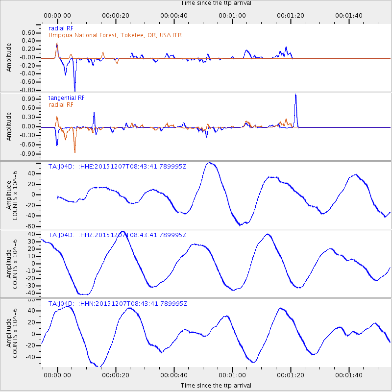
Signal To Noise
| Channel | StoN | STA | LTA |
| TA:J04D: :HHZ:20151207T08:43:41.789995Z | 0.53978664 | 1.4454592E-5 | 2.6778342E-5 |
| TA:J04D: :HHN:20151207T08:43:41.789995Z | 1.9305843 | 4.983205E-5 | 2.58119E-5 |
| TA:J04D: :HHE:20151207T08:43:41.789995Z | 0.69357705 | 7.0891983E-6 | 1.02212125E-5 |
| Arrivals |
| Ps | |
| PpPs | |
| PsPs/PpSs | |


