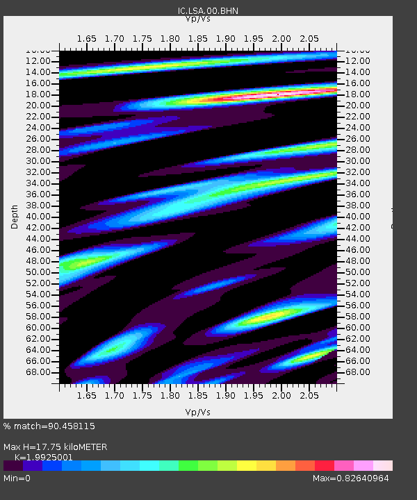
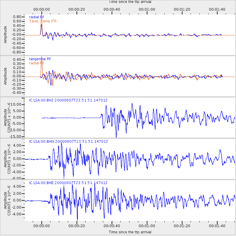
LSA Tibet, China - Earthquake Result Viewer

Earthquake location: Southern Sumatra, Indonesia
Earthquake latitude/longitude: -4.6/101.9
Earthquake time(UTC): 2000/06/07 (159) 23:45:26 GMT
Earthquake Depth: 33 km
Earthquake Magnitude: 6.1 MB, 6.7 MS, 6.7 MW, 6.5 MW
Earthquake Catalog/Contributor: WHDF/NEIC
Network: IC New China Digital Seismograph Network
Station: LSA Tibet, China
Lat/Lon: 29.70 N/91.15 E
Elevation: 3789 m
Distance: 35.6 deg
Az: 343.822 deg
Baz: 161.385 deg
Ray Param: 0.077052124
Estimated Moho Depth: 17.75 km
Estimated Crust Vp/Vs: 1.99
Assumed Crust Vp: 6.514 km/s
Estimated Crust Vs: 3.269 km/s
Estimated Crust Poisson's Ratio: 0.33
Radial Match: 90.458115 %
Radial Bump: 400
Transverse Match: 81.20823 %
Transverse Bump: 400
SOD ConfigId: 3744
Insert Time: 2010-03-04 22:38:27.428 +0000
GWidth: 2.5
Max Bumps: 400
Tol: 0.001

Signal To Noise

ChannelStoNSTALTA
IC:LSA:00:BHN:20000607T23:51:51.14701Z10.4720073.3693212E-73.2174555E-8
IC:LSA:00:BHE:20000607T23:51:51.14701Z3.61781882.3310686E-76.443298E-8
IC:LSA:00:BHZ:20000607T23:51:51.14701Z11.27861.0288182E-69.121862E-8
Arrivals
Ps2.9 SECOND
PpPs7.6 SECOND
PsPs/PpSs11 SECOND