You are here: Home > Network List > CI - Caltech Regional Seismic Network Stations List
> Station VES Vestal, Porterville, CA, USA > Earthquake Result Viewer
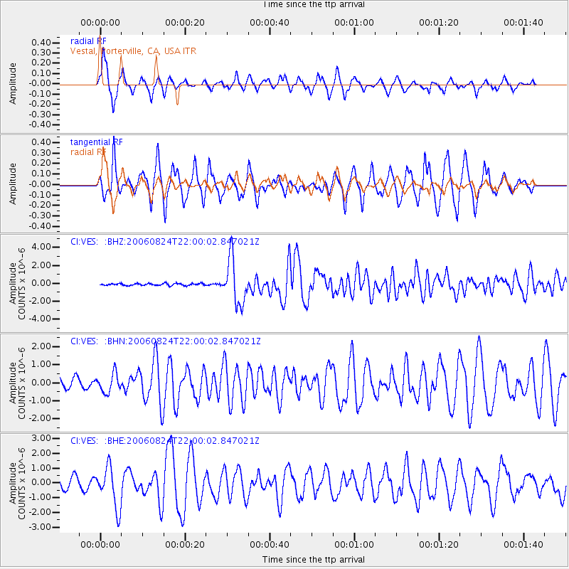
VES Vestal, Porterville, CA, USA - Earthquake Result Viewer

| Earthquake location: |
Near East Coast Of Kamchatka |
| Earthquake latitude/longitude: |
51.1/157.5 |
| Earthquake time(UTC): |
2006/08/24 (236) 21:50:36 GMT |
| Earthquake Depth: |
43 km |
| Earthquake Magnitude: |
5.9 MB, 6.2 MS, 6.5 MW, 6.5 MW |
| Earthquake Catalog/Contributor: |
WHDF/NEIC |
|
| Network: |
CI Caltech Regional Seismic Network |
| Station: |
VES Vestal, Porterville, CA, USA |
| Lat/Lon: |
35.84 N/119.08 W |
| Elevation: |
154 m |
|
| Distance: |
59.2 deg |
| Az: |
69.949 deg |
| Baz: |
313.262 deg |
| Ray Param: |
0.06223818 |
| Estimated Moho Depth: |
36.75 km |
| Estimated Crust Vp/Vs: |
1.86 |
| Assumed Crust Vp: |
6.1 km/s |
| Estimated Crust Vs: |
3.284 km/s |
| Estimated Crust Poisson's Ratio: |
0.30 |
|
| Radial Match: |
88.90321 % |
| Radial Bump: |
388 |
| Transverse Match: |
76.03392 % |
| Transverse Bump: |
361 |
| SOD ConfigId: |
2665 |
| Insert Time: |
2010-02-26 00:00:18.496 +0000 |
| GWidth: |
2.5 |
| Max Bumps: |
400 |
| Tol: |
0.001 |
|
Signal To Noise
| Channel | StoN | STA | LTA |
| CI:VES: :BHN:20060824T22:00:02.847021Z | 1.0446043 | 5.2356916E-7 | 5.012129E-7 |
| CI:VES: :BHE:20060824T22:00:02.847021Z | 3.7816725 | 1.40653E-6 | 3.7193334E-7 |
| CI:VES: :BHZ:20060824T22:00:02.847021Z | 23.692995 | 2.5549807E-6 | 1.07836975E-7 |
| Arrivals |
| Ps | 5.4 SECOND |
| PpPs | 17 SECOND |
| PsPs/PpSs | 22 SECOND |


