You are here: Home > Network List > CI - Caltech Regional Seismic Network Stations List
> Station LRL Laurel Mtn Radio Fac, Ridgecrest, CA, USA > Earthquake Result Viewer
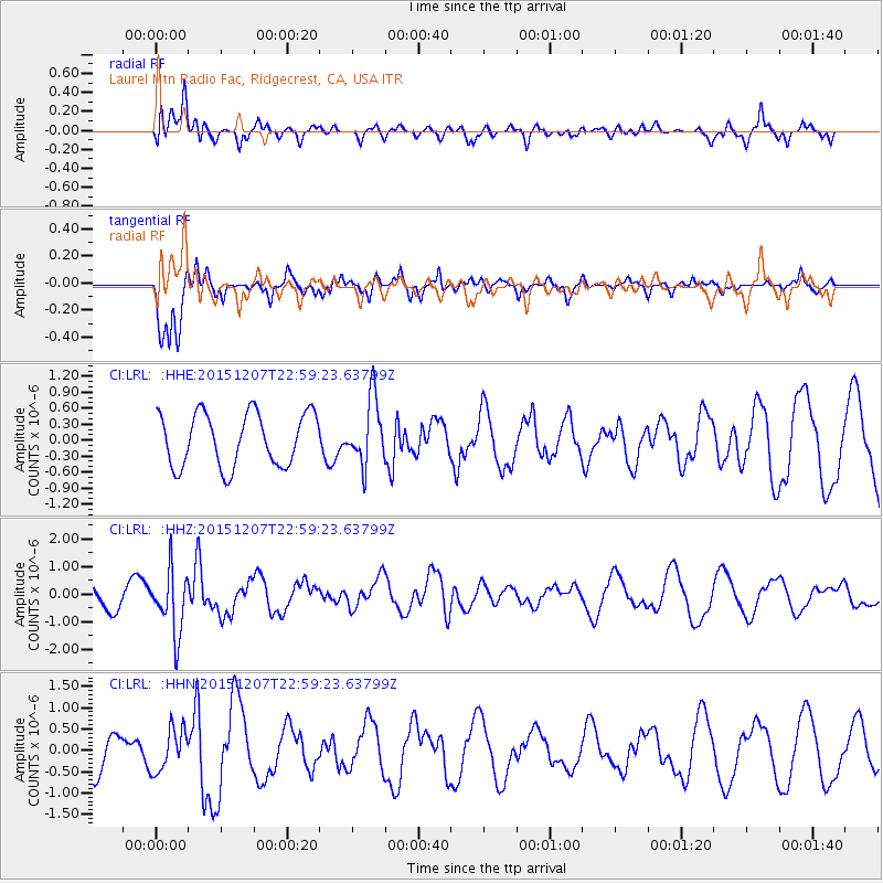
LRL Laurel Mtn Radio Fac, Ridgecrest, CA, USA - Earthquake Result Viewer
*The percent match for this event was below the threshold and hence no stack was calculated.
| Earthquake location: |
Guatemala |
| Earthquake latitude/longitude: |
14.2/-90.9 |
| Earthquake time(UTC): |
2015/12/07 (341) 22:53:36 GMT |
| Earthquake Depth: |
109 km |
| Earthquake Magnitude: |
5.7 MB |
| Earthquake Catalog/Contributor: |
NEIC PDE/NEIC COMCAT |
|
| Network: |
CI Caltech Regional Seismic Network |
| Station: |
LRL Laurel Mtn Radio Fac, Ridgecrest, CA, USA |
| Lat/Lon: |
35.48 N/117.68 W |
| Elevation: |
1340 m |
|
| Distance: |
32.1 deg |
| Az: |
316.09 deg |
| Baz: |
124.506 deg |
| Ray Param: |
$rayparam |
*The percent match for this event was below the threshold and hence was not used in the summary stack. |
|
| Radial Match: |
49.62549 % |
| Radial Bump: |
400 |
| Transverse Match: |
83.39292 % |
| Transverse Bump: |
329 |
| SOD ConfigId: |
7422571 |
| Insert Time: |
2019-04-21 13:52:24.133 +0000 |
| GWidth: |
2.5 |
| Max Bumps: |
400 |
| Tol: |
0.001 |
|
Signal To Noise
| Channel | StoN | STA | LTA |
| CI:LRL: :HHZ:20151207T22:59:23.63799Z | 2.645913 | 1.1345297E-6 | 4.2878574E-7 |
| CI:LRL: :HHN:20151207T22:59:23.63799Z | 1.3078388 | 4.9691954E-7 | 3.7995474E-7 |
| CI:LRL: :HHE:20151207T22:59:23.63799Z | 1.2344549 | 6.157645E-7 | 4.988149E-7 |
| Arrivals |
| Ps | |
| PpPs | |
| PsPs/PpSs | |


