You are here: Home > Network List > CI - Caltech Regional Seismic Network Stations List
> Station SMM Simmler, CA, USA > Earthquake Result Viewer
SMM Simmler, CA, USA - Earthquake Result Viewer
*The percent match for this event was below the threshold and hence no stack was calculated.
| Earthquake location: |
Guatemala |
| Earthquake latitude/longitude: |
14.2/-90.9 |
| Earthquake time(UTC): |
2015/12/07 (341) 22:53:36 GMT |
| Earthquake Depth: |
109 km |
| Earthquake Magnitude: |
5.7 MB |
| Earthquake Catalog/Contributor: |
NEIC PDE/NEIC COMCAT |
|
| Network: |
CI Caltech Regional Seismic Network |
| Station: |
SMM Simmler, CA, USA |
| Lat/Lon: |
35.31 N/120.00 W |
| Elevation: |
599 m |
|
| Distance: |
33.6 deg |
| Az: |
313.939 deg |
| Baz: |
121.364 deg |
| Ray Param: |
$rayparam |
*The percent match for this event was below the threshold and hence was not used in the summary stack. |
|
| Radial Match: |
69.14399 % |
| Radial Bump: |
400 |
| Transverse Match: |
63.397873 % |
| Transverse Bump: |
400 |
| SOD ConfigId: |
7422571 |
| Insert Time: |
2019-04-21 13:52:35.599 +0000 |
| GWidth: |
2.5 |
| Max Bumps: |
400 |
| Tol: |
0.001 |
|
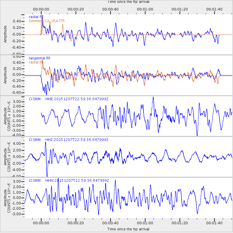
Signal To Noise
| Channel | StoN | STA | LTA |
| CI:SMM: :HHZ:20151207T22:59:36.647999Z | 4.2378664 | 2.462867E-6 | 5.8115734E-7 |
| CI:SMM: :HHN:20151207T22:59:36.647999Z | 0.6179639 | 8.427492E-7 | 1.3637515E-6 |
| CI:SMM: :HHE:20151207T22:59:36.647999Z | 1.1608086 | 1.2218435E-6 | 1.0525796E-6 |
| Arrivals |
| Ps | |
| PpPs | |
| PsPs/PpSs | |


