You are here: Home > Network List > TA - USArray Transportable Network (new EarthScope stations) Stations List
> Station J04D Umpqua National Forest, Toketee, OR, USA > Earthquake Result Viewer
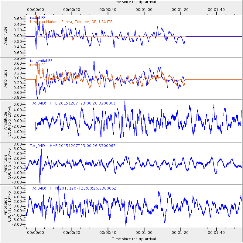
J04D Umpqua National Forest, Toketee, OR, USA - Earthquake Result Viewer
*The percent match for this event was below the threshold and hence no stack was calculated.
| Earthquake location: |
Guatemala |
| Earthquake latitude/longitude: |
14.2/-90.9 |
| Earthquake time(UTC): |
2015/12/07 (341) 22:53:36 GMT |
| Earthquake Depth: |
109 km |
| Earthquake Magnitude: |
5.7 MB |
| Earthquake Catalog/Contributor: |
NEIC PDE/NEIC COMCAT |
|
| Network: |
TA USArray Transportable Network (new EarthScope stations) |
| Station: |
J04D Umpqua National Forest, Toketee, OR, USA |
| Lat/Lon: |
43.24 N/122.11 W |
| Elevation: |
1948 m |
|
| Distance: |
39.4 deg |
| Az: |
323.345 deg |
| Baz: |
127.605 deg |
| Ray Param: |
$rayparam |
*The percent match for this event was below the threshold and hence was not used in the summary stack. |
|
| Radial Match: |
54.48425 % |
| Radial Bump: |
400 |
| Transverse Match: |
60.465424 % |
| Transverse Bump: |
400 |
| SOD ConfigId: |
7422571 |
| Insert Time: |
2019-04-21 13:56:08.017 +0000 |
| GWidth: |
2.5 |
| Max Bumps: |
400 |
| Tol: |
0.001 |
|
Signal To Noise
| Channel | StoN | STA | LTA |
| TA:J04D: :HHZ:20151207T23:00:26.330006Z | 2.8181517 | 3.0447227E-6 | 1.080397E-6 |
| TA:J04D: :HHN:20151207T23:00:26.330006Z | 1.0635097 | 1.8757939E-6 | 1.7637769E-6 |
| TA:J04D: :HHE:20151207T23:00:26.330006Z | 1.2607058 | 2.1550911E-6 | 1.7094321E-6 |
| Arrivals |
| Ps | |
| PpPs | |
| PsPs/PpSs | |


