You are here: Home > Network List > TA - USArray Transportable Network (new EarthScope stations) Stations List
> Station O03E Paynes Creek, CA, USA > Earthquake Result Viewer
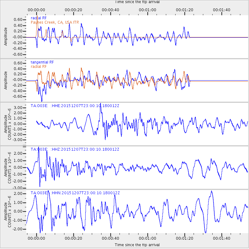
O03E Paynes Creek, CA, USA - Earthquake Result Viewer
*The percent match for this event was below the threshold and hence no stack was calculated.
| Earthquake location: |
Guatemala |
| Earthquake latitude/longitude: |
14.2/-90.9 |
| Earthquake time(UTC): |
2015/12/07 (341) 22:53:36 GMT |
| Earthquake Depth: |
109 km |
| Earthquake Magnitude: |
5.7 MB |
| Earthquake Catalog/Contributor: |
NEIC PDE/NEIC COMCAT |
|
| Network: |
TA USArray Transportable Network (new EarthScope stations) |
| Station: |
O03E Paynes Creek, CA, USA |
| Lat/Lon: |
40.29 N/121.80 W |
| Elevation: |
967 m |
|
| Distance: |
37.5 deg |
| Az: |
319.75 deg |
| Baz: |
124.994 deg |
| Ray Param: |
$rayparam |
*The percent match for this event was below the threshold and hence was not used in the summary stack. |
|
| Radial Match: |
68.665665 % |
| Radial Bump: |
400 |
| Transverse Match: |
61.485695 % |
| Transverse Bump: |
400 |
| SOD ConfigId: |
7422571 |
| Insert Time: |
2019-04-21 13:56:17.198 +0000 |
| GWidth: |
2.5 |
| Max Bumps: |
400 |
| Tol: |
0.001 |
|
Signal To Noise
| Channel | StoN | STA | LTA |
| TA:O03E: :HHZ:20151207T23:00:10.180012Z | 3.453227 | 1.3362991E-6 | 3.8697112E-7 |
| TA:O03E: :HHN:20151207T23:00:10.180012Z | 1.3534926 | 1.2484562E-6 | 9.22396E-7 |
| TA:O03E: :HHE:20151207T23:00:10.180012Z | 2.4158614 | 1.223855E-6 | 5.065915E-7 |
| Arrivals |
| Ps | |
| PpPs | |
| PsPs/PpSs | |


