You are here: Home > Network List > US - United States National Seismic Network Stations List
> Station LAO LASA Array, Montana, USA > Earthquake Result Viewer
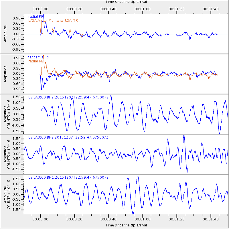
LAO LASA Array, Montana, USA - Earthquake Result Viewer
*The percent match for this event was below the threshold and hence no stack was calculated.
| Earthquake location: |
Guatemala |
| Earthquake latitude/longitude: |
14.2/-90.9 |
| Earthquake time(UTC): |
2015/12/07 (341) 22:53:36 GMT |
| Earthquake Depth: |
109 km |
| Earthquake Magnitude: |
5.7 MB |
| Earthquake Catalog/Contributor: |
NEIC PDE/NEIC COMCAT |
|
| Network: |
US United States National Seismic Network |
| Station: |
LAO LASA Array, Montana, USA |
| Lat/Lon: |
46.69 N/106.22 W |
| Elevation: |
902 m |
|
| Distance: |
34.8 deg |
| Az: |
341.376 deg |
| Baz: |
153.264 deg |
| Ray Param: |
$rayparam |
*The percent match for this event was below the threshold and hence was not used in the summary stack. |
|
| Radial Match: |
59.324993 % |
| Radial Bump: |
370 |
| Transverse Match: |
60.45611 % |
| Transverse Bump: |
400 |
| SOD ConfigId: |
7422571 |
| Insert Time: |
2019-04-21 13:56:30.152 +0000 |
| GWidth: |
2.5 |
| Max Bumps: |
400 |
| Tol: |
0.001 |
|
Signal To Noise
| Channel | StoN | STA | LTA |
| US:LAO:00:BHZ:20151207T22:59:47.675007Z | 1.9372022 | 5.50195E-7 | 2.8401527E-7 |
| US:LAO:00:BH1:20151207T22:59:47.675007Z | 0.6629493 | 2.5907545E-7 | 3.9079225E-7 |
| US:LAO:00:BH2:20151207T22:59:47.675007Z | 0.59959346 | 4.7419925E-7 | 7.9086794E-7 |
| Arrivals |
| Ps | |
| PpPs | |
| PsPs/PpSs | |


