LSA Tibet, China - Earthquake Result Viewer
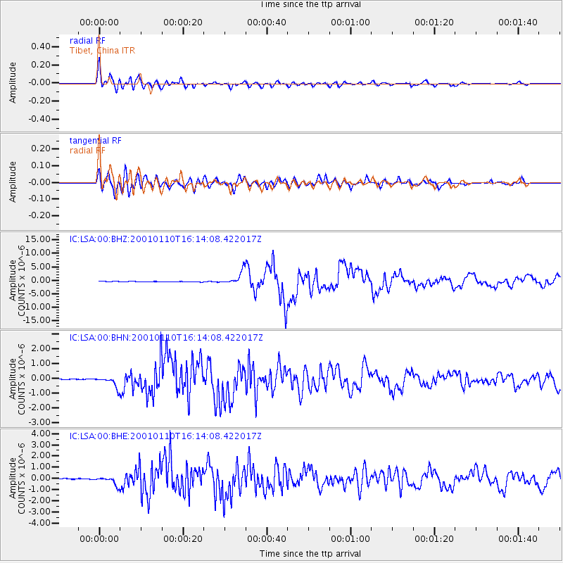
Earthquake location: Kodiak Island Region, Alaska
Earthquake latitude/longitude: 57.1/-153.2
Earthquake time(UTC): 2001/01/10 (010) 16:02:44 GMT
Earthquake Depth: 33 km
Earthquake Magnitude: 6.2 MB, 6.8 MS, 7.1 MW, 6.8 ML
Earthquake Catalog/Contributor: WHDF/NEIC
Network: IC New China Digital Seismograph Network
Station: LSA Tibet, China
Lat/Lon: 29.70 N/91.15 E
Elevation: 3789 m
Distance: 78.0 deg
Az: 306.696 deg
Baz: 30.215 deg
Ray Param: 0.049872622
Estimated Moho Depth: 22.0 km
Estimated Crust Vp/Vs: 1.94
Assumed Crust Vp: 6.514 km/s
Estimated Crust Vs: 3.362 km/s
Estimated Crust Poisson's Ratio: 0.32
Radial Match: 93.79974 %
Radial Bump: 400
Transverse Match: 85.867584 %
Transverse Bump: 400
SOD ConfigId: 3744
Insert Time: 2010-03-04 22:40:44.180 +0000
GWidth: 2.5
Max Bumps: 400
Tol: 0.001

Signal To Noise

ChannelStoNSTALTA
IC:LSA:00:BHN:20010110T16:14:08.422017Z12.9358473.798372E-72.9363148E-8
IC:LSA:00:BHE:20010110T16:14:08.422017Z12.631984.2394456E-73.3561214E-8
IC:LSA:00:BHZ:20010110T16:14:08.422017Z24.5320012.5487518E-61.0389498E-7
Arrivals
Ps3.3 SECOND
PpPs9.6 SECOND
PsPs/PpSs13 SECOND