LSA Tibet, China - Earthquake Result Viewer
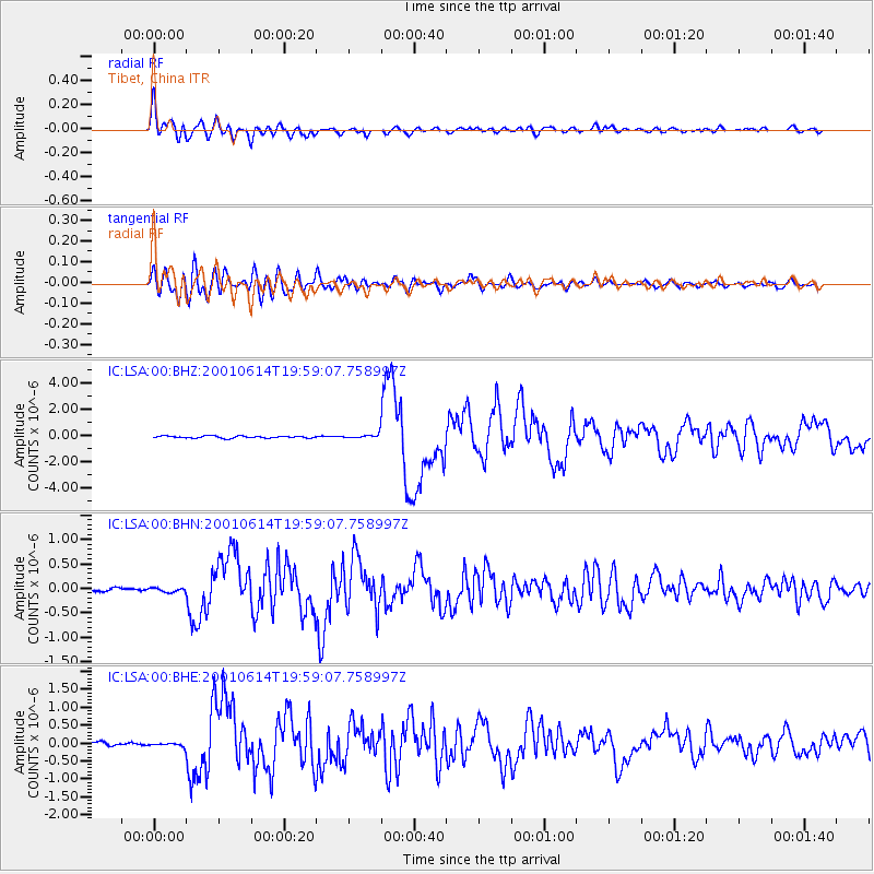
Earthquake location: Andreanof Islands, Aleutian Is.
Earthquake latitude/longitude: 51.2/-179.8
Earthquake time(UTC): 2001/06/14 (165) 19:48:47 GMT
Earthquake Depth: 18 km
Earthquake Magnitude: 6.0 MB, 6.3 MS, 6.5 MW, 6.1 ML
Earthquake Catalog/Contributor: WHDF/NEIC
Network: IC New China Digital Seismograph Network
Station: LSA Tibet, China
Lat/Lon: 29.70 N/91.15 E
Elevation: 3789 m
Distance: 66.9 deg
Az: 288.961 deg
Baz: 43.195 deg
Ray Param: 0.05729036
Estimated Moho Depth: 24.75 km
Estimated Crust Vp/Vs: 1.68
Assumed Crust Vp: 6.514 km/s
Estimated Crust Vs: 3.889 km/s
Estimated Crust Poisson's Ratio: 0.22
Radial Match: 94.72711 %
Radial Bump: 400
Transverse Match: 84.5064 %
Transverse Bump: 400
SOD ConfigId: 4714
Insert Time: 2010-03-04 22:41:02.834 +0000
GWidth: 2.5
Max Bumps: 400
Tol: 0.001

Signal To Noise

ChannelStoNSTALTA
IC:LSA:00:BHN:20010614T19:59:07.758997Z1.39125494.298729E-83.089821E-8
IC:LSA:00:BHE:20010614T19:59:07.758997Z1.83817676.225686E-83.386881E-8
IC:LSA:00:BHZ:20010614T19:59:07.758997Z1.87863161.5300137E-78.1442984E-8
Arrivals
Ps2.7 SECOND
PpPs9.7 SECOND
PsPs/PpSs12 SECOND