
LSA Tibet, China - Earthquake Result Viewer
| ||||||||||||||||||
| ||||||||||||||||||
| ||||||||||||||||||
|
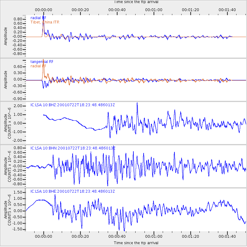
Signal To Noise
| Channel | StoN | STA | LTA |
| IC:LSA:10:BHN:20010722T18:23:48.486013Z | 1.779577 | 6.071138E-8 | 3.4115622E-8 |
| IC:LSA:10:BHE:20010722T18:23:48.486013Z | 2.503991 | 1.2915049E-6 | 5.157786E-7 |
| IC:LSA:10:BHZ:20010722T18:23:48.486013Z | 2.2768607 | 8.9846844E-7 | 3.9460843E-7 |
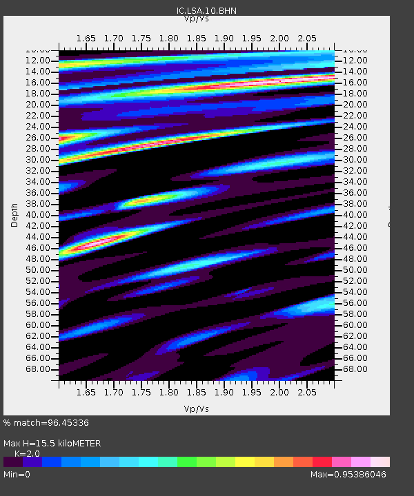
| Arrivals | |
| Ps | 2.5 SECOND |
| PpPs | 6.8 SECOND |
| PsPs/PpSs | 9.3 SECOND |

