You are here: Home > Network List > PF - Volcanologic Network of Piton de Fournaise-OVPF Stations List
> Station HIM cratere Himiltrude > Earthquake Result Viewer
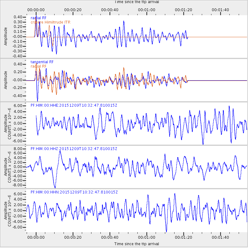
HIM cratere Himiltrude - Earthquake Result Viewer
*The percent match for this event was below the threshold and hence no stack was calculated.
| Earthquake location: |
Banda Sea |
| Earthquake latitude/longitude: |
-4.1/129.5 |
| Earthquake time(UTC): |
2015/12/09 (343) 10:21:50 GMT |
| Earthquake Depth: |
34 km |
| Earthquake Magnitude: |
6.9 MWP |
| Earthquake Catalog/Contributor: |
NEIC PDE/NEIC COMCAT |
|
| Network: |
PF Volcanologic Network of Piton de Fournaise-OVPF |
| Station: |
HIM cratere Himiltrude |
| Lat/Lon: |
21.21 S/55.72 E |
| Elevation: |
1958 m |
|
| Distance: |
73.4 deg |
| Az: |
249.207 deg |
| Baz: |
87.979 deg |
| Ray Param: |
$rayparam |
*The percent match for this event was below the threshold and hence was not used in the summary stack. |
|
| Radial Match: |
59.131233 % |
| Radial Bump: |
400 |
| Transverse Match: |
63.9142 % |
| Transverse Bump: |
400 |
| SOD ConfigId: |
7422571 |
| Insert Time: |
2019-04-21 14:08:37.340 +0000 |
| GWidth: |
2.5 |
| Max Bumps: |
400 |
| Tol: |
0.001 |
|
Signal To Noise
| Channel | StoN | STA | LTA |
| PF:HIM:00:HHZ:20151209T10:32:47.810015Z | 2.7918777 | 2.4391063E-6 | 8.7364367E-7 |
| PF:HIM:00:HHN:20151209T10:32:47.810015Z | 0.977166 | 1.9593876E-6 | 2.0051739E-6 |
| PF:HIM:00:HHE:20151209T10:32:47.810015Z | 1.9217662 | 2.9915404E-6 | 1.5566619E-6 |
| Arrivals |
| Ps | |
| PpPs | |
| PsPs/PpSs | |


