
LSA Tibet, China - Earthquake Result Viewer
| ||||||||||||||||||
| ||||||||||||||||||
| ||||||||||||||||||
|
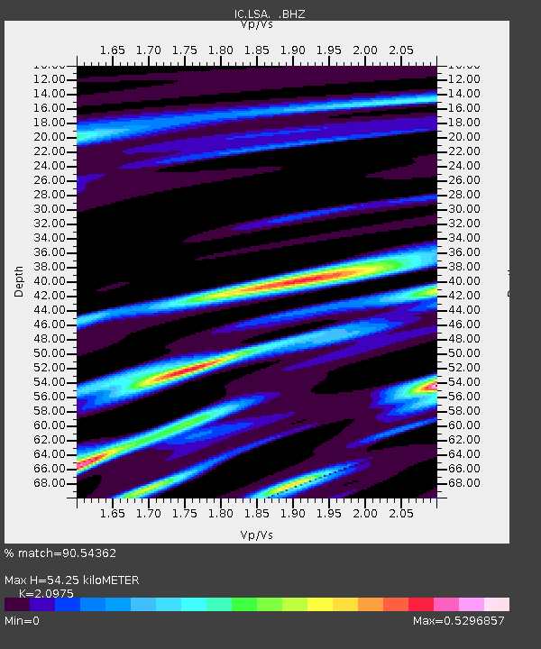
Signal To Noise
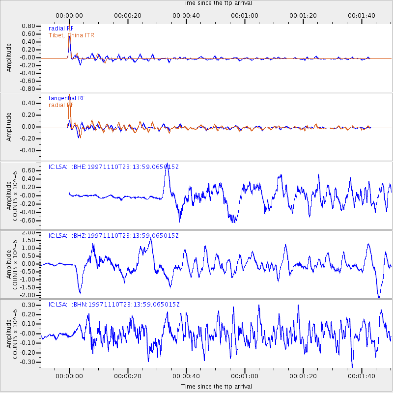
| Channel | StoN | STA | LTA |
| IC:LSA: :BHZ:19971110T23:13:59.065015Z | 9.24237 | 7.8221746E-7 | 8.463387E-8 |
| IC:LSA: :BHN:19971110T23:13:59.065015Z | 1.9155159 | 4.3516398E-8 | 2.2717847E-8 |
| IC:LSA: :BHE:19971110T23:13:59.065015Z | 13.076786 | 3.5310623E-7 | 2.7002525E-8 |
| Arrivals | |
| Ps | 9.7 SECOND |
| PpPs | 24 SECOND |
| PsPs/PpSs | 34 SECOND |

