
LSA Tibet, China - Earthquake Result Viewer
| ||||||||||||||||||
| ||||||||||||||||||
| ||||||||||||||||||
|
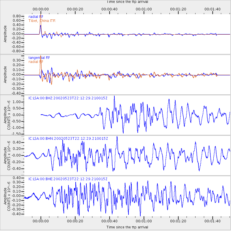
Signal To Noise
| Channel | StoN | STA | LTA |
| IC:LSA:00:BHN:20020523T22:12:29.210015Z | 1.5421568 | 7.319751E-8 | 4.7464376E-8 |
| IC:LSA:00:BHE:20020523T22:12:29.210015Z | 1.4768199 | 5.2997184E-8 | 3.5886018E-8 |
| IC:LSA:00:BHZ:20020523T22:12:29.210015Z | 2.2080548 | 2.0958501E-7 | 9.491839E-8 |
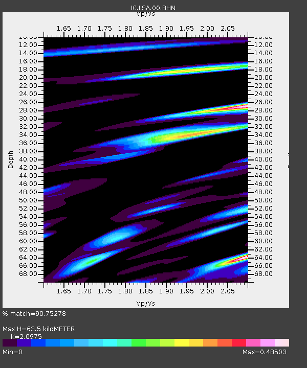
| Arrivals | |
| Ps | 11 SECOND |
| PpPs | 28 SECOND |
| PsPs/PpSs | 40 SECOND |

