
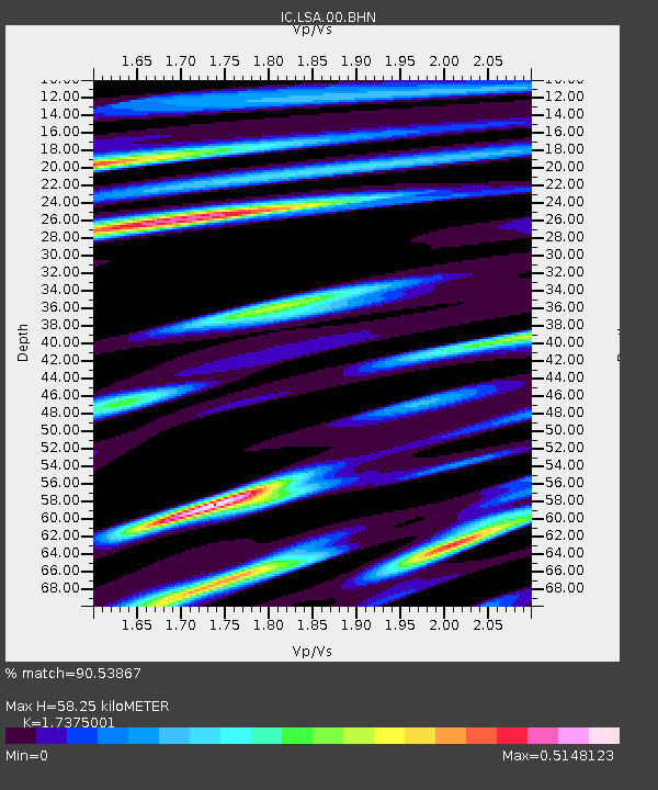
LSA Tibet, China - Earthquake Result Viewer
| ||||||||||||||||||
| ||||||||||||||||||
| ||||||||||||||||||
|
Signal To Noise
| Channel | StoN | STA | LTA |
| IC:LSA:00:BHN:20020110T11:24:24.98603Z | 1.1936066 | 2.9138253E-8 | 2.4411941E-8 |
| IC:LSA:00:BHE:20020110T11:24:24.98603Z | 0.73351413 | 6.883619E-8 | 9.384439E-8 |
| IC:LSA:00:BHZ:20020110T11:24:24.98603Z | 1.3646442 | 7.052304E-8 | 5.1678704E-8 |
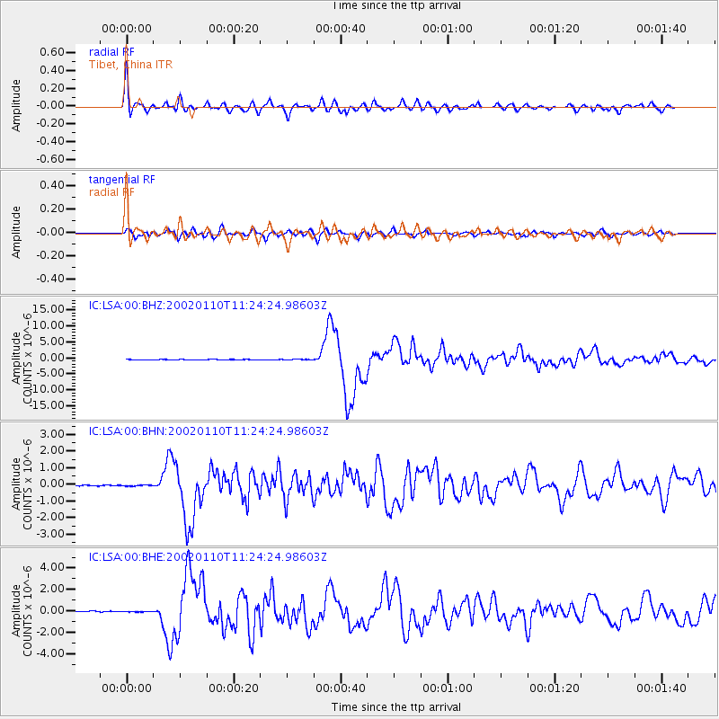
| Arrivals | |
| Ps | 6.9 SECOND |
| PpPs | 23 SECOND |
| PsPs/PpSs | 30 SECOND |

