You are here: Home > Network List > CI - Caltech Regional Seismic Network Stations List
> Station MPM Manuel Prospect Mine, California, USA > Earthquake Result Viewer
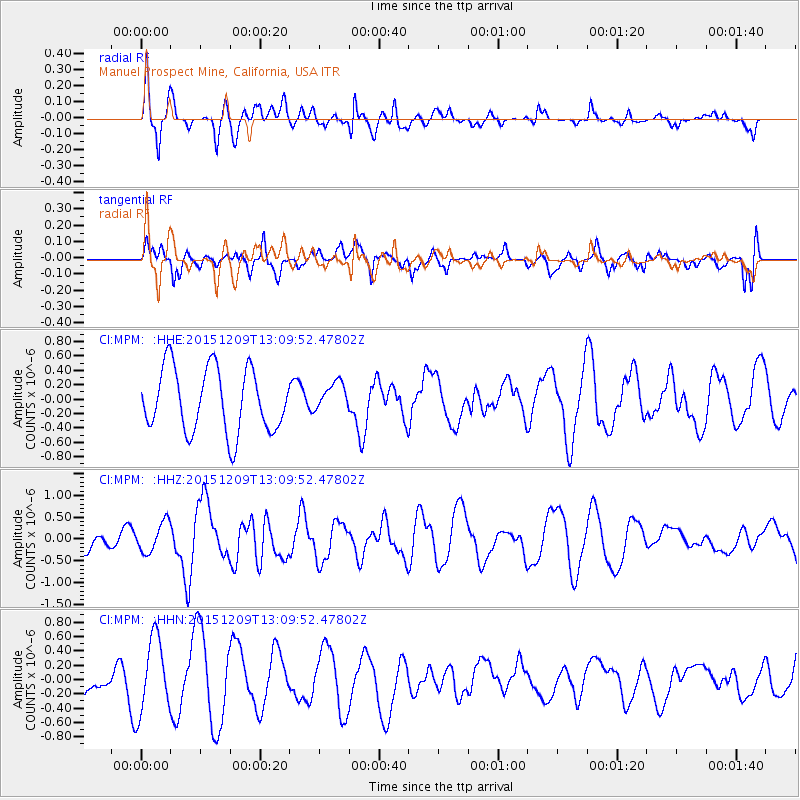
MPM Manuel Prospect Mine, California, USA - Earthquake Result Viewer
*The percent match for this event was below the threshold and hence no stack was calculated.
| Earthquake location: |
Fiji Islands Region |
| Earthquake latitude/longitude: |
-16.6/175.3 |
| Earthquake time(UTC): |
2015/12/09 (343) 12:58:01 GMT |
| Earthquake Depth: |
10 km |
| Earthquake Magnitude: |
5.7 MB |
| Earthquake Catalog/Contributor: |
NEIC PDE/NEIC COMCAT |
|
| Network: |
CI Caltech Regional Seismic Network |
| Station: |
MPM Manuel Prospect Mine, California, USA |
| Lat/Lon: |
36.06 N/117.49 W |
| Elevation: |
185 m |
|
| Distance: |
82.3 deg |
| Az: |
48.937 deg |
| Baz: |
243.144 deg |
| Ray Param: |
$rayparam |
*The percent match for this event was below the threshold and hence was not used in the summary stack. |
|
| Radial Match: |
57.654533 % |
| Radial Bump: |
375 |
| Transverse Match: |
30.404827 % |
| Transverse Bump: |
400 |
| SOD ConfigId: |
7422571 |
| Insert Time: |
2019-04-21 14:13:25.948 +0000 |
| GWidth: |
2.5 |
| Max Bumps: |
400 |
| Tol: |
0.001 |
|
Signal To Noise
| Channel | StoN | STA | LTA |
| CI:MPM: :HHZ:20151209T13:09:52.47802Z | 1.1706275 | 3.4925375E-7 | 2.9834746E-7 |
| CI:MPM: :HHN:20151209T13:09:52.47802Z | 1.9394984 | 5.199479E-7 | 2.6808368E-7 |
| CI:MPM: :HHE:20151209T13:09:52.47802Z | 0.45811334 | 2.0520504E-7 | 4.4793507E-7 |
| Arrivals |
| Ps | |
| PpPs | |
| PsPs/PpSs | |


