You are here: Home > Network List > US - United States National Seismic Network Stations List
> Station DGMT Dagmar, Montana, USA > Earthquake Result Viewer
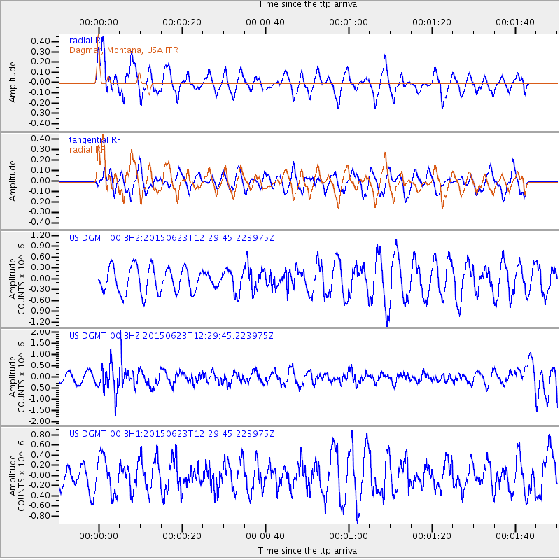
DGMT Dagmar, Montana, USA - Earthquake Result Viewer
*The percent match for this event was below the threshold and hence no stack was calculated.
| Earthquake location: |
Bonin Islands, Japan Region |
| Earthquake latitude/longitude: |
27.7/139.8 |
| Earthquake time(UTC): |
2015/06/23 (174) 12:18:29 GMT |
| Earthquake Depth: |
456 km |
| Earthquake Magnitude: |
6.3 MO |
| Earthquake Catalog/Contributor: |
NEIC PDE/NEIC ALERT |
|
| Network: |
US United States National Seismic Network |
| Station: |
DGMT Dagmar, Montana, USA |
| Lat/Lon: |
48.47 N/104.20 W |
| Elevation: |
0.0 m |
|
| Distance: |
85.1 deg |
| Az: |
36.892 deg |
| Baz: |
306.866 deg |
| Ray Param: |
$rayparam |
*The percent match for this event was below the threshold and hence was not used in the summary stack. |
|
| Radial Match: |
64.75229 % |
| Radial Bump: |
400 |
| Transverse Match: |
50.15637 % |
| Transverse Bump: |
400 |
| SOD ConfigId: |
976571 |
| Insert Time: |
2015-07-07 12:36:41.781 +0000 |
| GWidth: |
2.5 |
| Max Bumps: |
400 |
| Tol: |
0.001 |
|
Signal To Noise
| Channel | StoN | STA | LTA |
| US:DGMT:00:BHZ:20150623T12:29:45.223975Z | 3.2528052 | 5.95135E-7 | 1.8296055E-7 |
| US:DGMT:00:BH1:20150623T12:29:45.223975Z | 2.0106347 | 3.540775E-7 | 1.7610238E-7 |
| US:DGMT:00:BH2:20150623T12:29:45.223975Z | 0.8826376 | 3.113161E-7 | 3.527111E-7 |
| Arrivals |
| Ps | |
| PpPs | |
| PsPs/PpSs | |


