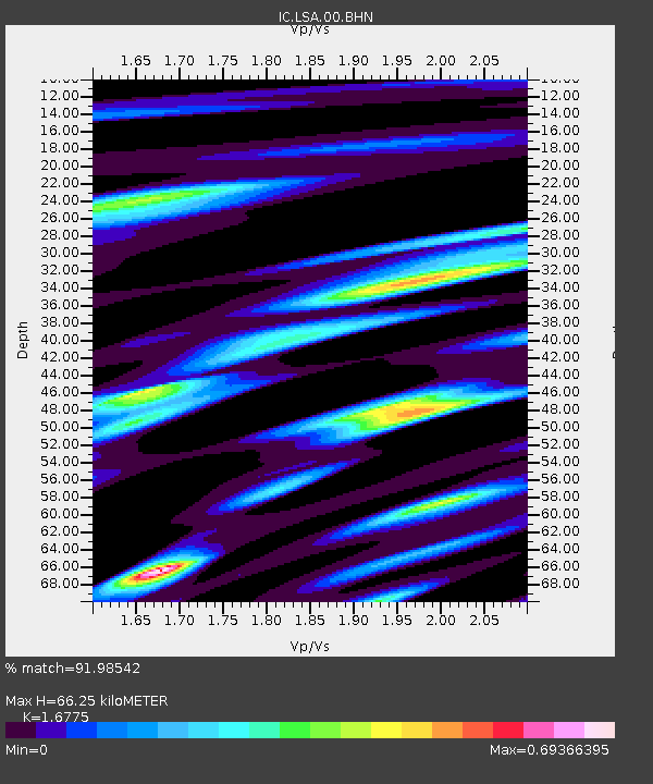
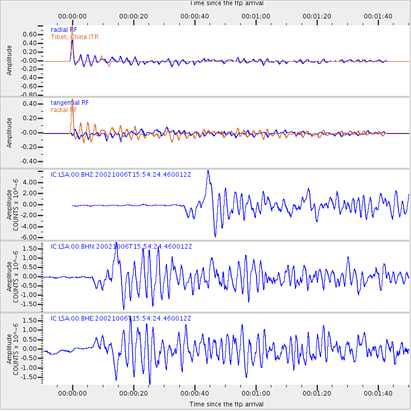
LSA Tibet, China - Earthquake Result Viewer

Earthquake location: Sumbawa Region, Indonesia
Earthquake latitude/longitude: -8.2/118.3
Earthquake time(UTC): 2002/10/06 (279) 15:46:33 GMT
Earthquake Depth: 10 km
Earthquake Magnitude: 5.8 MB, 6.0 MS, 6.2 MW, 6.2 MW
Earthquake Catalog/Contributor: WHDF/NEIC
Network: IC New China Digital Seismograph Network
Station: LSA Tibet, China
Lat/Lon: 29.70 N/91.15 E
Elevation: 3789 m
Distance: 45.9 deg
Az: 326.364 deg
Baz: 140.934 deg
Ray Param: 0.070995845
Estimated Moho Depth: 66.25 km
Estimated Crust Vp/Vs: 1.68
Assumed Crust Vp: 6.514 km/s
Estimated Crust Vs: 3.883 km/s
Estimated Crust Poisson's Ratio: 0.22
Radial Match: 91.98542 %
Radial Bump: 367
Transverse Match: 81.25033 %
Transverse Bump: 400
SOD ConfigId: 4714
Insert Time: 2010-03-04 22:42:34.503 +0000
GWidth: 2.5
Max Bumps: 400
Tol: 0.001

Signal To Noise

ChannelStoNSTALTA
IC:LSA:00:BHN:20021006T15:54:24.460012Z1.19331681.8503927E-81.5506298E-8
IC:LSA:00:BHE:20021006T15:54:24.460012Z1.06401731.0677412E-71.0034998E-7
IC:LSA:00:BHZ:20021006T15:54:24.460012Z1.26016158.185656E-86.49572E-8
Arrivals
Ps7.4 SECOND
PpPs25 SECOND
PsPs/PpSs33 SECOND