
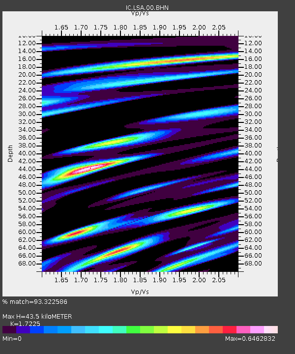
LSA Tibet, China - Earthquake Result Viewer
| ||||||||||||||||||
| ||||||||||||||||||
| ||||||||||||||||||
|
Signal To Noise
| Channel | StoN | STA | LTA |
| IC:LSA:00:BHN:20021010T10:58:56.905999Z | 9.90501 | 3.8651416E-7 | 3.9022087E-8 |
| IC:LSA:00:BHE:20021010T10:58:56.905999Z | 7.170305 | 6.486335E-7 | 9.046107E-8 |
| IC:LSA:00:BHZ:20021010T10:58:56.905999Z | 16.503778 | 1.985874E-6 | 1.2032844E-7 |
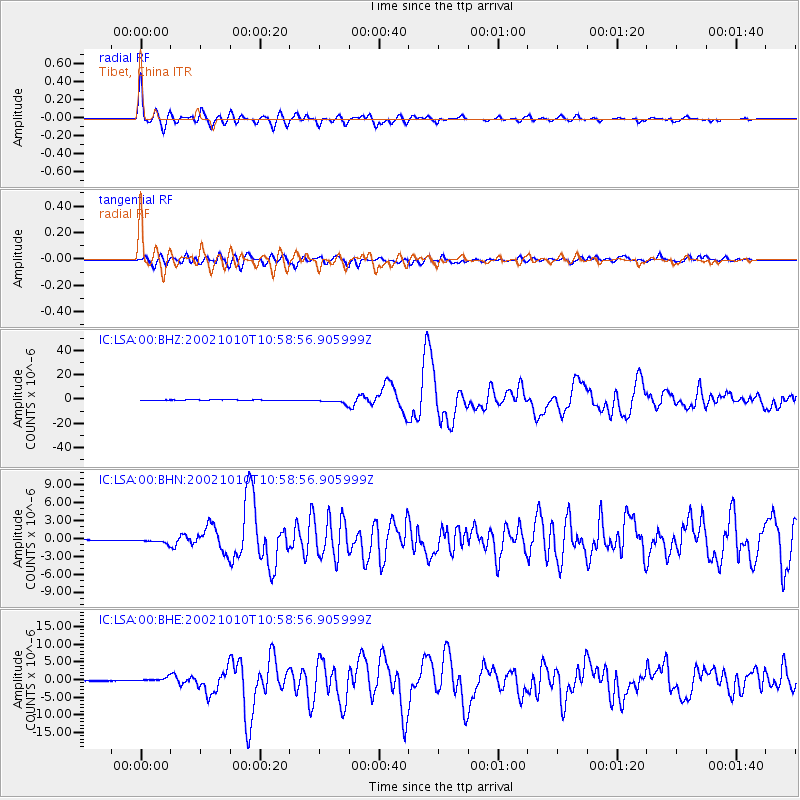
| Arrivals | |
| Ps | 5.1 SECOND |
| PpPs | 17 SECOND |
| PsPs/PpSs | 22 SECOND |

