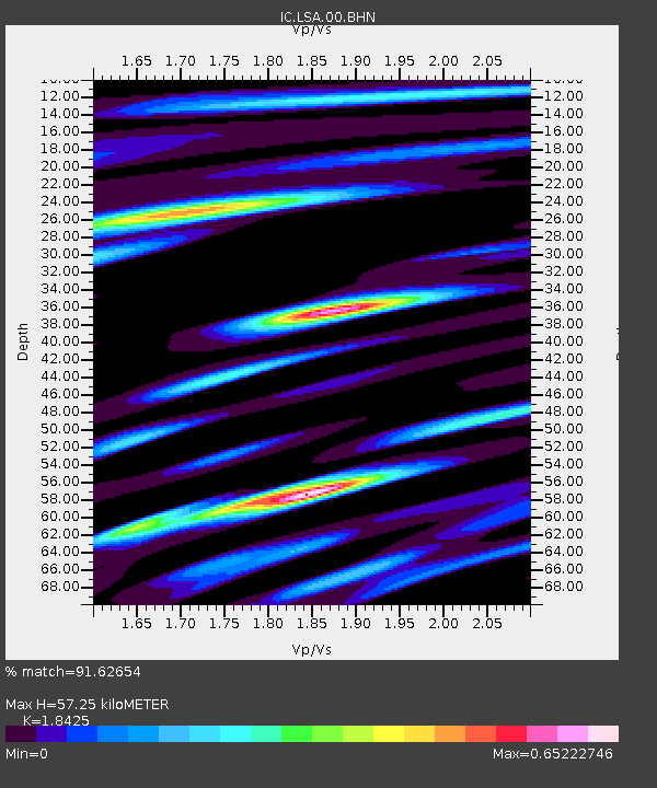
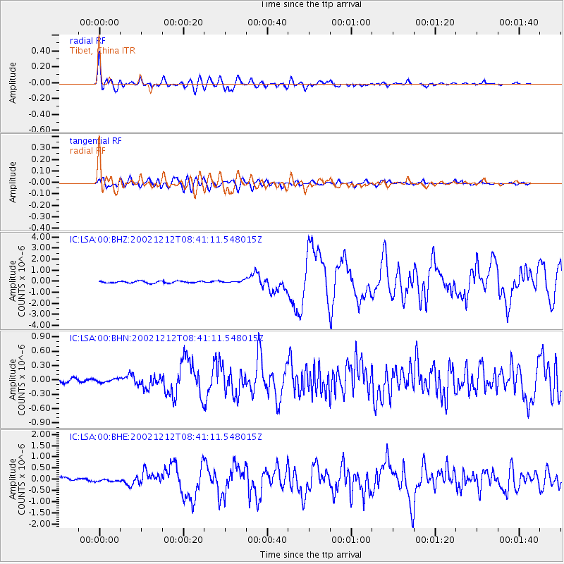
LSA Tibet, China - Earthquake Result Viewer

Earthquake location: New Ireland Region, P.N.G.
Earthquake latitude/longitude: -4.8/153.3
Earthquake time(UTC): 2002/12/12 (346) 08:30:42 GMT
Earthquake Depth: 34 km
Earthquake Magnitude: 5.9 MB, 6.7 MS, 6.7 MW, 6.6 MW
Earthquake Catalog/Contributor: WHDF/NEIC
Network: IC New China Digital Seismograph Network
Station: LSA Tibet, China
Lat/Lon: 29.70 N/91.15 E
Elevation: 3789 m
Distance: 68.6 deg
Az: 304.316 deg
Baz: 108.911 deg
Ray Param: 0.05613117
Estimated Moho Depth: 57.25 km
Estimated Crust Vp/Vs: 1.84
Assumed Crust Vp: 6.514 km/s
Estimated Crust Vs: 3.536 km/s
Estimated Crust Poisson's Ratio: 0.29
Radial Match: 91.62654 %
Radial Bump: 400
Transverse Match: 84.90461 %
Transverse Bump: 400
SOD ConfigId: 4714
Insert Time: 2010-03-04 22:42:38.318 +0000
GWidth: 2.5
Max Bumps: 400
Tol: 0.001

Signal To Noise

ChannelStoNSTALTA
IC:LSA:00:BHN:20021212T08:41:11.548015Z1.1277863.5574434E-83.1543603E-8
IC:LSA:00:BHE:20021212T08:41:11.548015Z0.373960825.054871E-81.3517113E-7
IC:LSA:00:BHZ:20021212T08:41:11.548015Z1.24640171.0491569E-78.4174864E-8
Arrivals
Ps7.7 SECOND
PpPs24 SECOND
PsPs/PpSs32 SECOND