You are here: Home > Network List > US - United States National Seismic Network Stations List
> Station HAWA Hanford, Washington, USA > Earthquake Result Viewer
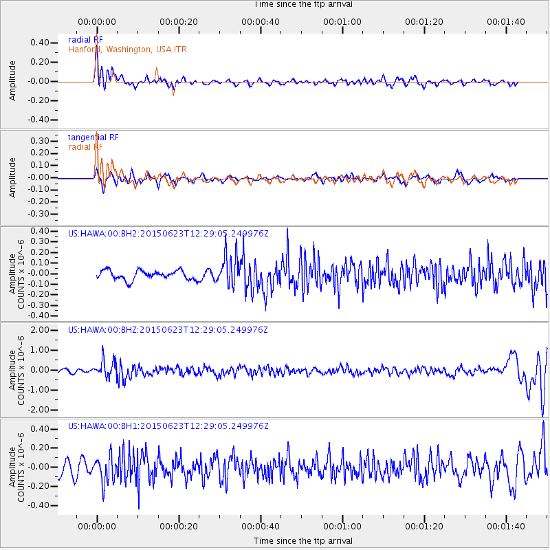
HAWA Hanford, Washington, USA - Earthquake Result Viewer
*The percent match for this event was below the threshold and hence no stack was calculated.
| Earthquake location: |
Bonin Islands, Japan Region |
| Earthquake latitude/longitude: |
27.7/139.8 |
| Earthquake time(UTC): |
2015/06/23 (174) 12:18:29 GMT |
| Earthquake Depth: |
456 km |
| Earthquake Magnitude: |
6.3 MO |
| Earthquake Catalog/Contributor: |
NEIC PDE/NEIC ALERT |
|
| Network: |
US United States National Seismic Network |
| Station: |
HAWA Hanford, Washington, USA |
| Lat/Lon: |
46.39 N/119.53 W |
| Elevation: |
364 m |
|
| Distance: |
77.3 deg |
| Az: |
44.202 deg |
| Baz: |
296.696 deg |
| Ray Param: |
$rayparam |
*The percent match for this event was below the threshold and hence was not used in the summary stack. |
|
| Radial Match: |
72.009926 % |
| Radial Bump: |
400 |
| Transverse Match: |
45.785877 % |
| Transverse Bump: |
385 |
| SOD ConfigId: |
976571 |
| Insert Time: |
2015-07-07 12:36:57.069 +0000 |
| GWidth: |
2.5 |
| Max Bumps: |
400 |
| Tol: |
0.001 |
|
Signal To Noise
| Channel | StoN | STA | LTA |
| US:HAWA:00:BHZ:20150623T12:29:05.249976Z | 7.180434 | 4.338848E-7 | 6.042598E-8 |
| US:HAWA:00:BH1:20150623T12:29:05.249976Z | 1.7335254 | 1.3718227E-7 | 7.913485E-8 |
| US:HAWA:00:BH2:20150623T12:29:05.249976Z | 3.4230745 | 1.4876397E-7 | 4.345917E-8 |
| Arrivals |
| Ps | |
| PpPs | |
| PsPs/PpSs | |


