
LSA Tibet, China - Earthquake Result Viewer
| ||||||||||||||||||
| ||||||||||||||||||
| ||||||||||||||||||
|
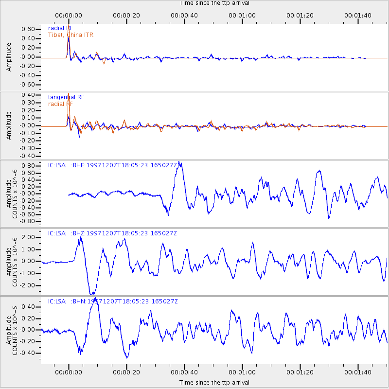
Signal To Noise
| Channel | StoN | STA | LTA |
| IC:LSA: :BHZ:19971207T18:05:23.165027Z | 16.019567 | 1.067631E-6 | 6.6645434E-8 |
| IC:LSA: :BHN:19971207T18:05:23.165027Z | 10.109126 | 2.0228217E-7 | 2.0009857E-8 |
| IC:LSA: :BHE:19971207T18:05:23.165027Z | 6.1874394 | 2.9139545E-7 | 4.7094677E-8 |
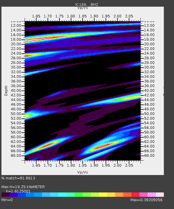
| Arrivals | |
| Ps | 1.8 SECOND |
| PpPs | 6.9 SECOND |
| PsPs/PpSs | 8.7 SECOND |

