
LSA Tibet, China - Earthquake Result Viewer
| ||||||||||||||||||
| ||||||||||||||||||
| ||||||||||||||||||
|
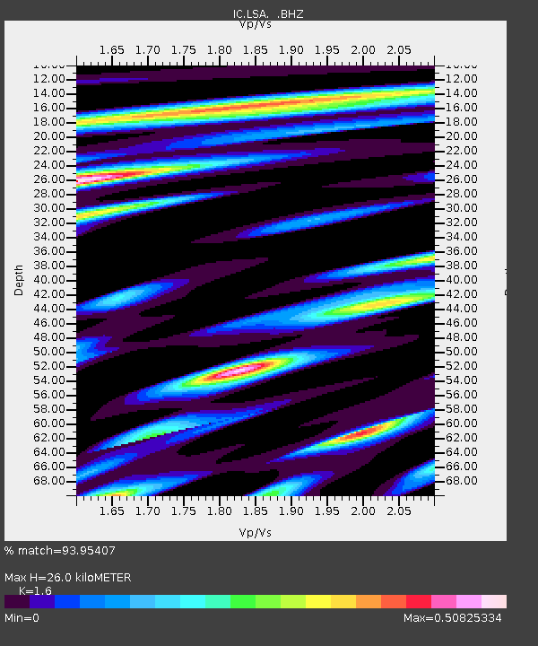
Signal To Noise
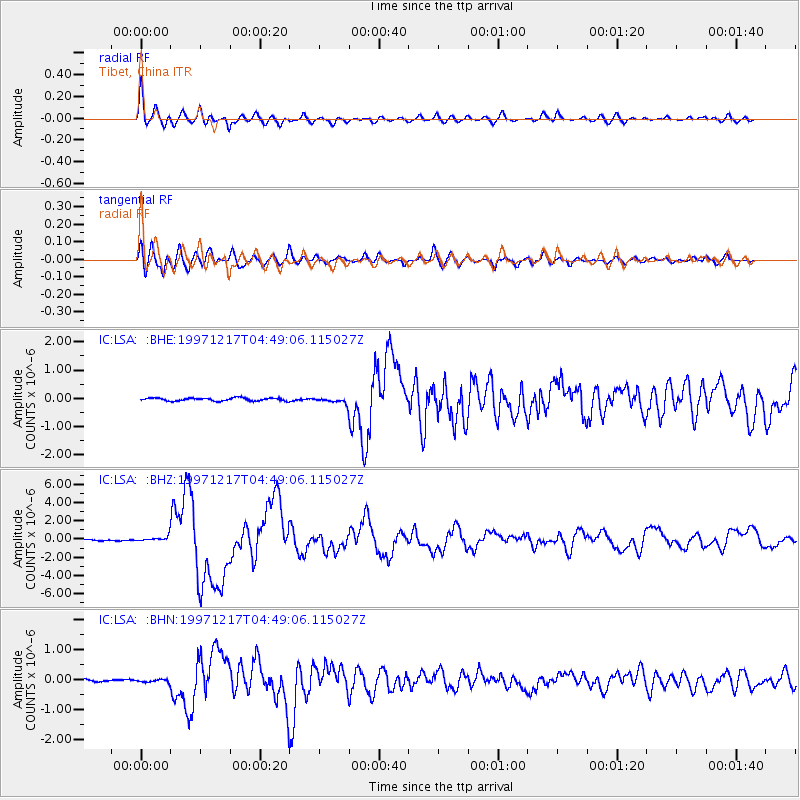
| Channel | StoN | STA | LTA |
| IC:LSA: :BHZ:19971217T04:49:06.115027Z | 2.6819208 | 2.831781E-7 | 1.055878E-7 |
| IC:LSA: :BHN:19971217T04:49:06.115027Z | 1.1865773 | 4.51387E-8 | 3.8041094E-8 |
| IC:LSA: :BHE:19971217T04:49:06.115027Z | 1.5709838 | 8.0618015E-8 | 5.1316896E-8 |
| Arrivals | |
| Ps | 2.5 SECOND |
| PpPs | 9.9 SECOND |
| PsPs/PpSs | 12 SECOND |

