
LSA Tibet, China - Earthquake Result Viewer
| ||||||||||||||||||
| ||||||||||||||||||
| ||||||||||||||||||
|
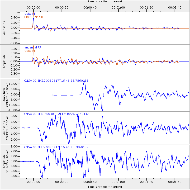
Signal To Noise
| Channel | StoN | STA | LTA |
| IC:LSA:00:BHN:20030317T16:46:26.786013Z | 8.172895 | 2.9767386E-7 | 3.642208E-8 |
| IC:LSA:00:BHE:20030317T16:46:26.786013Z | 6.220209 | 5.177053E-7 | 8.3229565E-8 |
| IC:LSA:00:BHZ:20030317T16:46:26.786013Z | 18.383919 | 2.1052804E-6 | 1.145175E-7 |
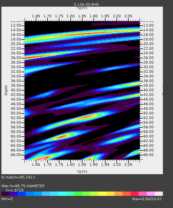
| Arrivals | |
| Ps | 7.5 SECOND |
| PpPs | 27 SECOND |
| PsPs/PpSs | 35 SECOND |

