You are here: Home > Network List > IU - Global Seismograph Network (GSN - IRIS/USGS) Stations List
> Station POHA Pohakuloa, Hawaii, USA > Earthquake Result Viewer
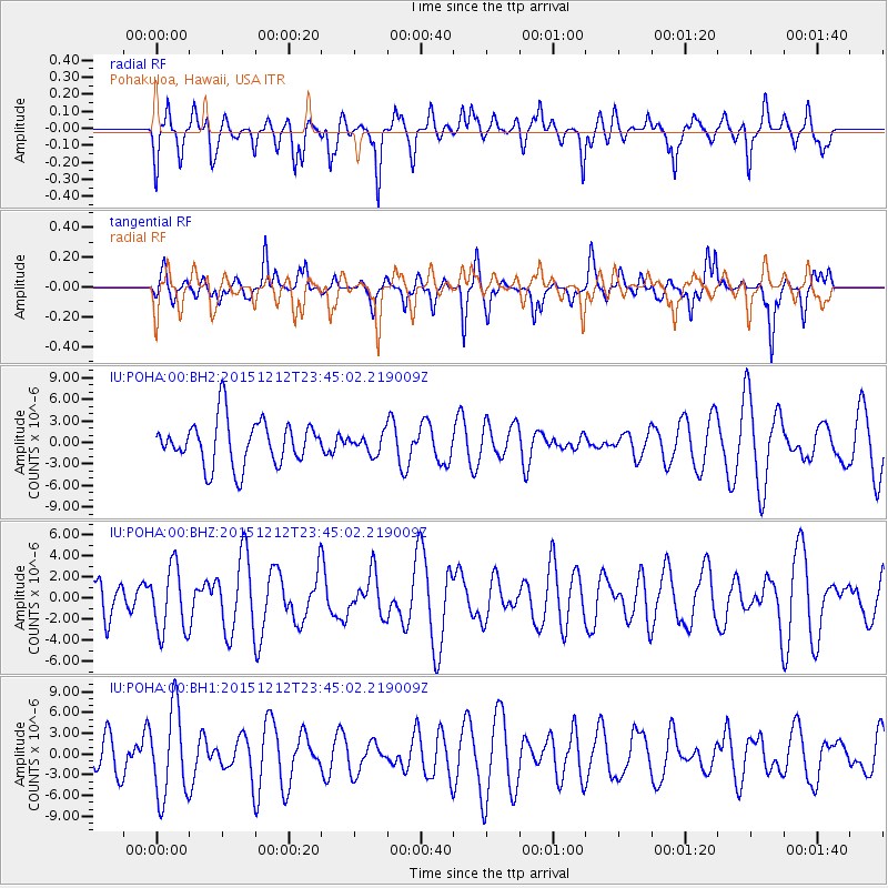
POHA Pohakuloa, Hawaii, USA - Earthquake Result Viewer
*The percent match for this event was below the threshold and hence no stack was calculated.
| Earthquake location: |
Southeast Of Easter Island |
| Earthquake latitude/longitude: |
-41.1/-90.1 |
| Earthquake time(UTC): |
2015/12/12 (346) 23:32:54 GMT |
| Earthquake Depth: |
10 km |
| Earthquake Magnitude: |
5.5 mwb |
| Earthquake Catalog/Contributor: |
NEIC PDE/us |
|
| Network: |
IU Global Seismograph Network (GSN - IRIS/USGS) |
| Station: |
POHA Pohakuloa, Hawaii, USA |
| Lat/Lon: |
19.76 N/155.53 W |
| Elevation: |
1990 m |
|
| Distance: |
85.7 deg |
| Az: |
300.768 deg |
| Baz: |
136.42 deg |
| Ray Param: |
$rayparam |
*The percent match for this event was below the threshold and hence was not used in the summary stack. |
|
| Radial Match: |
44.0288 % |
| Radial Bump: |
371 |
| Transverse Match: |
53.42236 % |
| Transverse Bump: |
296 |
| SOD ConfigId: |
7422571 |
| Insert Time: |
2019-04-21 14:30:25.075 +0000 |
| GWidth: |
2.5 |
| Max Bumps: |
400 |
| Tol: |
0.001 |
|
Signal To Noise
| Channel | StoN | STA | LTA |
| IU:POHA:00:BHZ:20151212T23:45:02.219009Z | 2.0133352 | 3.1223785E-6 | 1.5508489E-6 |
| IU:POHA:00:BH1:20151212T23:45:02.219009Z | 2.327703 | 6.3820908E-6 | 2.7417977E-6 |
| IU:POHA:00:BH2:20151212T23:45:02.219009Z | 0.4196995 | 1.3142009E-6 | 3.1312902E-6 |
| Arrivals |
| Ps | |
| PpPs | |
| PsPs/PpSs | |


