You are here: Home > Network List > AK - Alaska Regional Network Stations List
> Station CUT Chulitna, AK, USA > Earthquake Result Viewer
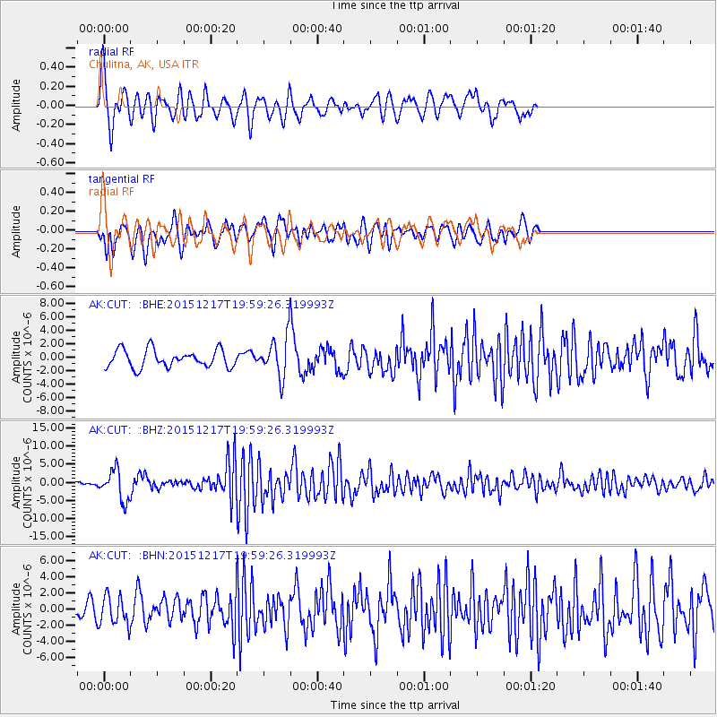
CUT Chulitna, AK, USA - Earthquake Result Viewer
*The percent match for this event was below the threshold and hence no stack was calculated.
| Earthquake location: |
Near Coast Of Chiapas, Mexico |
| Earthquake latitude/longitude: |
15.9/-93.4 |
| Earthquake time(UTC): |
2015/12/17 (351) 19:49:54 GMT |
| Earthquake Depth: |
97 km |
| Earthquake Magnitude: |
6.4 MWB, 6.6 MI |
| Earthquake Catalog/Contributor: |
NEIC PDE/NEIC COMCAT |
|
| Network: |
AK Alaska Regional Network |
| Station: |
CUT Chulitna, AK, USA |
| Lat/Lon: |
62.41 N/150.26 W |
| Elevation: |
574 m |
|
| Distance: |
60.9 deg |
| Az: |
333.513 deg |
| Baz: |
112.834 deg |
| Ray Param: |
$rayparam |
*The percent match for this event was below the threshold and hence was not used in the summary stack. |
|
| Radial Match: |
73.06868 % |
| Radial Bump: |
400 |
| Transverse Match: |
61.16264 % |
| Transverse Bump: |
400 |
| SOD ConfigId: |
7422571 |
| Insert Time: |
2019-04-21 14:35:59.508 +0000 |
| GWidth: |
2.5 |
| Max Bumps: |
400 |
| Tol: |
0.001 |
|
Signal To Noise
| Channel | StoN | STA | LTA |
| AK:CUT: :BHZ:20151217T19:59:26.319993Z | 6.4690475 | 4.220502E-6 | 6.524147E-7 |
| AK:CUT: :BHN:20151217T19:59:26.319993Z | 1.5929735 | 1.792857E-6 | 1.1254782E-6 |
| AK:CUT: :BHE:20151217T19:59:26.319993Z | 2.9460282 | 3.796922E-6 | 1.2888275E-6 |
| Arrivals |
| Ps | |
| PpPs | |
| PsPs/PpSs | |


