
LSA Tibet, China - Earthquake Result Viewer
| ||||||||||||||||||
| ||||||||||||||||||
| ||||||||||||||||||
|
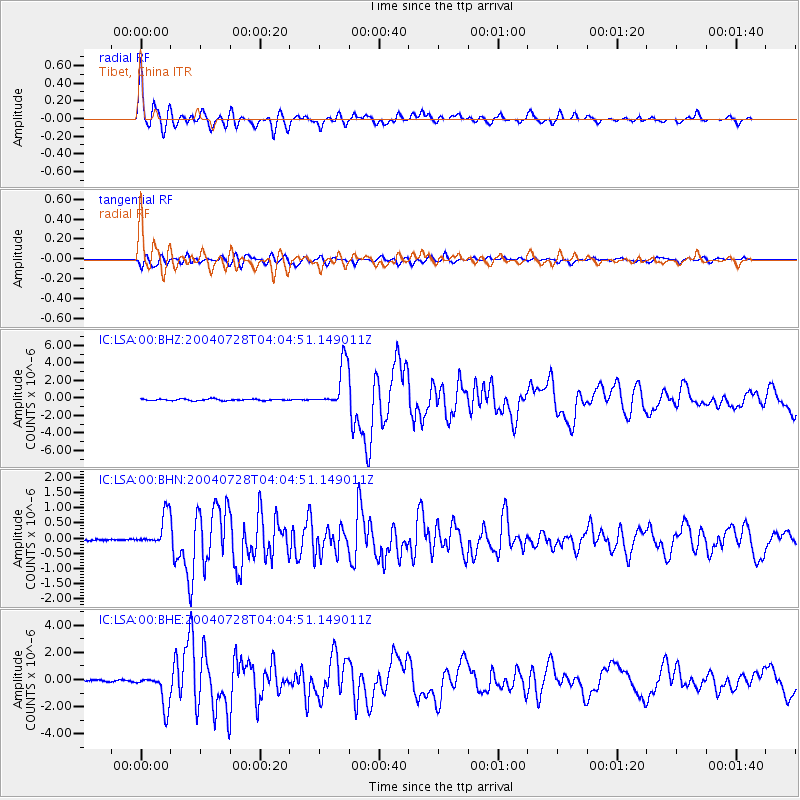
Signal To Noise
| Channel | StoN | STA | LTA |
| IC:LSA:00:BHN:20040728T04:04:51.149011Z | 23.76342 | 5.30889E-7 | 2.2340597E-8 |
| IC:LSA:00:BHE:20040728T04:04:51.149011Z | 24.400606 | 1.2279734E-6 | 5.0325525E-8 |
| IC:LSA:00:BHZ:20040728T04:04:51.149011Z | 28.55999 | 2.5147572E-6 | 8.805175E-8 |
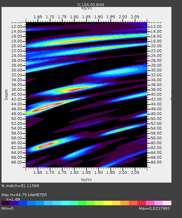
| Arrivals | |
| Ps | 5.0 SECOND |
| PpPs | 17 SECOND |
| PsPs/PpSs | 22 SECOND |

