You are here: Home > Network List > WY - Yellowstone Wyoming Seismic Network Stations List
> Station YHH Holmes Hill, YNP, WY, USA > Earthquake Result Viewer
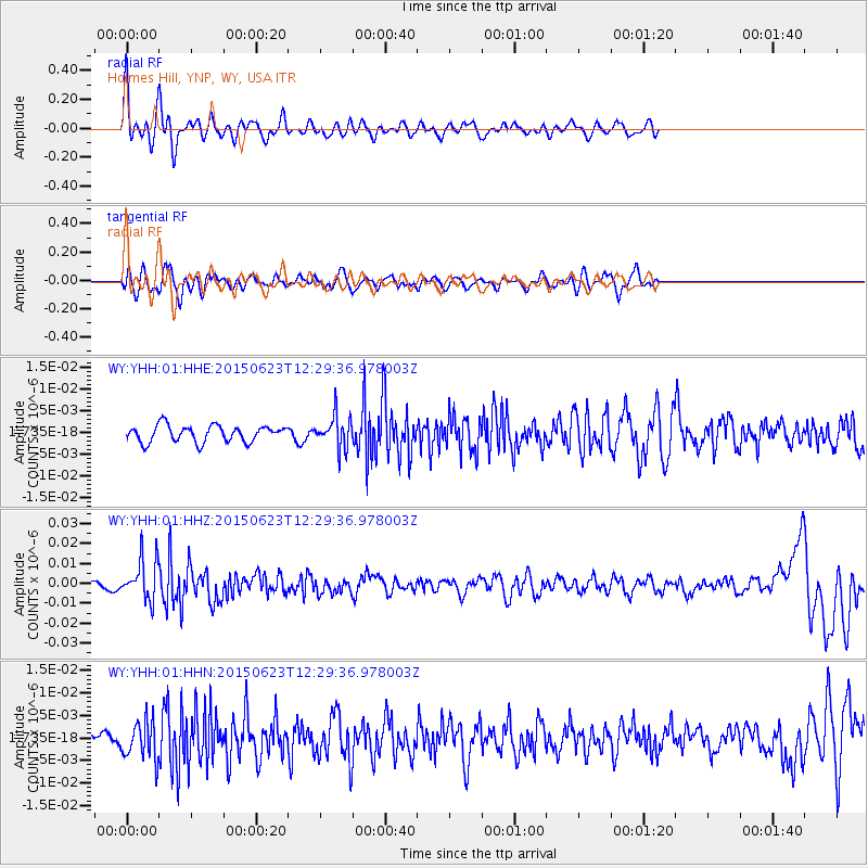
YHH Holmes Hill, YNP, WY, USA - Earthquake Result Viewer
*The percent match for this event was below the threshold and hence no stack was calculated.
| Earthquake location: |
Bonin Islands, Japan Region |
| Earthquake latitude/longitude: |
27.7/139.8 |
| Earthquake time(UTC): |
2015/06/23 (174) 12:18:29 GMT |
| Earthquake Depth: |
456 km |
| Earthquake Magnitude: |
6.3 MO |
| Earthquake Catalog/Contributor: |
NEIC PDE/NEIC ALERT |
|
| Network: |
WY Yellowstone Wyoming Seismic Network |
| Station: |
YHH Holmes Hill, YNP, WY, USA |
| Lat/Lon: |
44.79 N/110.85 W |
| Elevation: |
2717 m |
|
| Distance: |
83.4 deg |
| Az: |
42.556 deg |
| Baz: |
302.608 deg |
| Ray Param: |
$rayparam |
*The percent match for this event was below the threshold and hence was not used in the summary stack. |
|
| Radial Match: |
74.888435 % |
| Radial Bump: |
400 |
| Transverse Match: |
55.868458 % |
| Transverse Bump: |
400 |
| SOD ConfigId: |
976571 |
| Insert Time: |
2015-07-07 12:38:26.287 +0000 |
| GWidth: |
2.5 |
| Max Bumps: |
400 |
| Tol: |
0.001 |
|
Signal To Noise
| Channel | StoN | STA | LTA |
| WY:YHH:01:HHZ:20150623T12:29:36.978003Z | 4.5930333 | 1.0147673E-8 | 2.2093618E-9 |
| WY:YHH:01:HHN:20150623T12:29:36.978003Z | 2.6457322 | 4.309759E-9 | 1.6289478E-9 |
| WY:YHH:01:HHE:20150623T12:29:36.978003Z | 1.9661174 | 3.7298715E-9 | 1.8970747E-9 |
| Arrivals |
| Ps | |
| PpPs | |
| PsPs/PpSs | |


