You are here: Home > Network List > TA - USArray Transportable Network (new EarthScope stations) Stations List
> Station H04D Lebanon, OR, USA > Earthquake Result Viewer
H04D Lebanon, OR, USA - Earthquake Result Viewer
*The percent match for this event was below the threshold and hence no stack was calculated.
| Earthquake location: |
Near Coast Of Chiapas, Mexico |
| Earthquake latitude/longitude: |
15.9/-93.4 |
| Earthquake time(UTC): |
2015/12/17 (351) 19:49:54 GMT |
| Earthquake Depth: |
97 km |
| Earthquake Magnitude: |
6.4 MWB, 6.6 MI |
| Earthquake Catalog/Contributor: |
NEIC PDE/NEIC COMCAT |
|
| Network: |
TA USArray Transportable Network (new EarthScope stations) |
| Station: |
H04D Lebanon, OR, USA |
| Lat/Lon: |
44.52 N/122.74 W |
| Elevation: |
284 m |
|
| Distance: |
37.8 deg |
| Az: |
325.141 deg |
| Baz: |
129.746 deg |
| Ray Param: |
$rayparam |
*The percent match for this event was below the threshold and hence was not used in the summary stack. |
|
| Radial Match: |
70.13954 % |
| Radial Bump: |
400 |
| Transverse Match: |
54.72638 % |
| Transverse Bump: |
400 |
| SOD ConfigId: |
7422571 |
| Insert Time: |
2019-04-21 14:42:13.060 +0000 |
| GWidth: |
2.5 |
| Max Bumps: |
400 |
| Tol: |
0.001 |
|
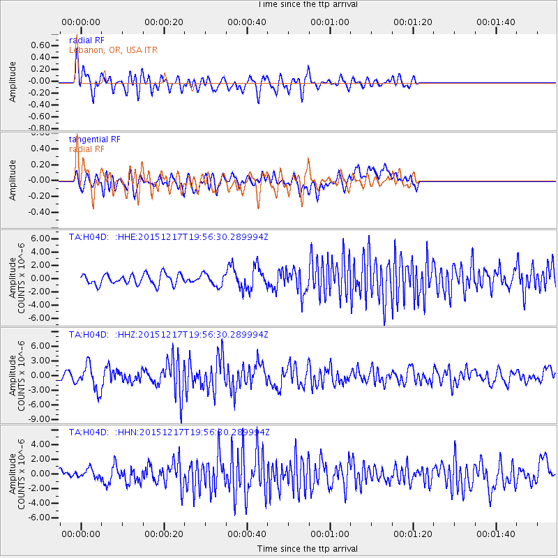
Signal To Noise
| Channel | StoN | STA | LTA |
| TA:H04D: :HHZ:20151217T19:56:30.289994Z | 5.393184 | 2.640789E-6 | 4.89653E-7 |
| TA:H04D: :HHN:20151217T19:56:30.289994Z | 0.74869174 | 6.164486E-7 | 8.2336766E-7 |
| TA:H04D: :HHE:20151217T19:56:30.289994Z | 1.458432 | 1.1473795E-6 | 7.8672133E-7 |
| Arrivals |
| Ps | |
| PpPs | |
| PsPs/PpSs | |


