
LSA Tibet, China - Earthquake Result Viewer
| ||||||||||||||||||
| ||||||||||||||||||
| ||||||||||||||||||
|
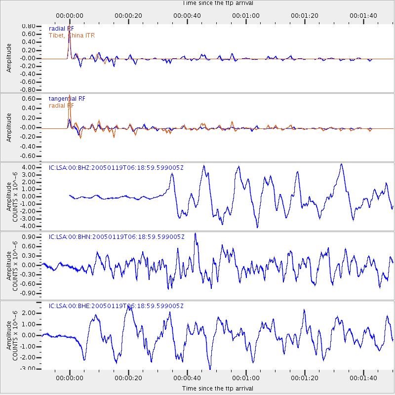
Signal To Noise
| Channel | StoN | STA | LTA |
| IC:LSA:00:BHN:20050119T06:18:59.599005Z | 1.0510949 | 7.257571E-8 | 6.904772E-8 |
| IC:LSA:00:BHE:20050119T06:18:59.599005Z | 10.019377 | 7.893672E-7 | 7.878406E-8 |
| IC:LSA:00:BHZ:20050119T06:18:59.599005Z | 8.595242 | 1.1976801E-6 | 1.3934223E-7 |
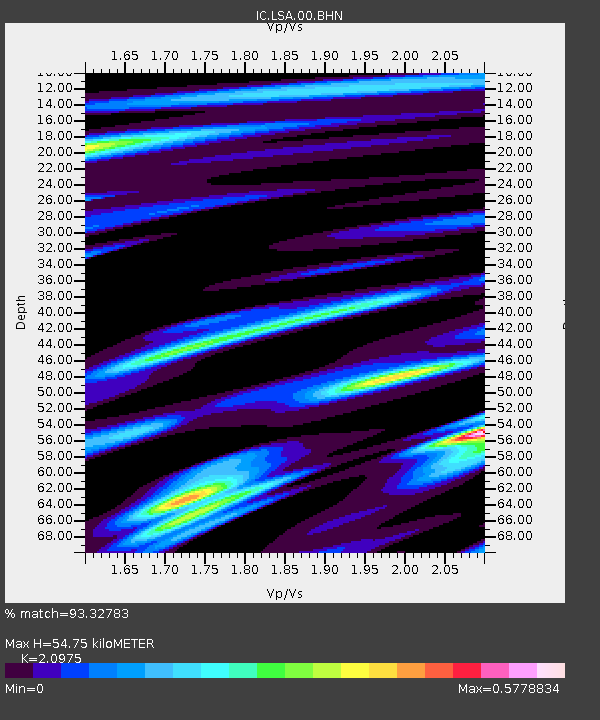
| Arrivals | |
| Ps | 9.8 SECOND |
| PpPs | 25 SECOND |
| PsPs/PpSs | 34 SECOND |

