You are here: Home > Network List > UW - Pacific Northwest Regional Seismic Network Stations List
> Station LTY Liberty (broad-band) > Earthquake Result Viewer
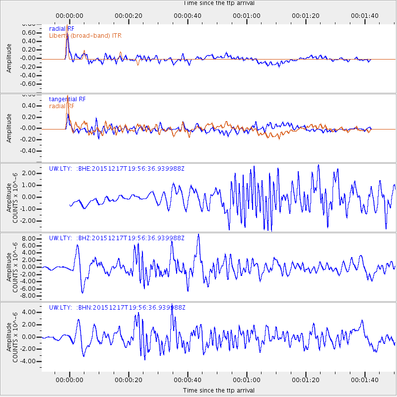
LTY Liberty (broad-band) - Earthquake Result Viewer
*The percent match for this event was below the threshold and hence no stack was calculated.
| Earthquake location: |
Near Coast Of Chiapas, Mexico |
| Earthquake latitude/longitude: |
15.9/-93.4 |
| Earthquake time(UTC): |
2015/12/17 (351) 19:49:54 GMT |
| Earthquake Depth: |
97 km |
| Earthquake Magnitude: |
6.4 MWB, 6.6 MI |
| Earthquake Catalog/Contributor: |
NEIC PDE/NEIC COMCAT |
|
| Network: |
UW Pacific Northwest Regional Seismic Network |
| Station: |
LTY Liberty (broad-band) |
| Lat/Lon: |
47.26 N/120.66 W |
| Elevation: |
970 m |
|
| Distance: |
38.6 deg |
| Az: |
329.987 deg |
| Baz: |
135.042 deg |
| Ray Param: |
$rayparam |
*The percent match for this event was below the threshold and hence was not used in the summary stack. |
|
| Radial Match: |
78.01708 % |
| Radial Bump: |
400 |
| Transverse Match: |
70.38431 % |
| Transverse Bump: |
400 |
| SOD ConfigId: |
7422571 |
| Insert Time: |
2019-04-21 14:43:14.371 +0000 |
| GWidth: |
2.5 |
| Max Bumps: |
400 |
| Tol: |
0.001 |
|
Signal To Noise
| Channel | StoN | STA | LTA |
| UW:LTY: :BHZ:20151217T19:56:36.939988Z | 15.999536 | 3.7613793E-6 | 2.3509304E-7 |
| UW:LTY: :BHN:20151217T19:56:36.939988Z | 7.587486 | 1.5975517E-6 | 2.1055087E-7 |
| UW:LTY: :BHE:20151217T19:56:36.939988Z | 2.5820253 | 7.0016347E-7 | 2.7116832E-7 |
| Arrivals |
| Ps | |
| PpPs | |
| PsPs/PpSs | |


