
LSA Tibet, China - Earthquake Result Viewer
| ||||||||||||||||||
| ||||||||||||||||||
| ||||||||||||||||||
|
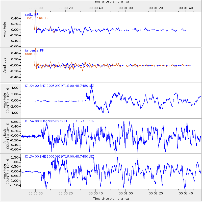
Signal To Noise
| Channel | StoN | STA | LTA |
| IC:LSA:00:BHN:20050929T16:00:48.748018Z | 4.4544787 | 1.1077073E-7 | 2.4867271E-8 |
| IC:LSA:00:BHE:20050929T16:00:48.748018Z | 7.514577 | 3.020815E-7 | 4.01994E-8 |
| IC:LSA:00:BHZ:20050929T16:00:48.748018Z | 12.360087 | 9.147982E-7 | 7.401227E-8 |
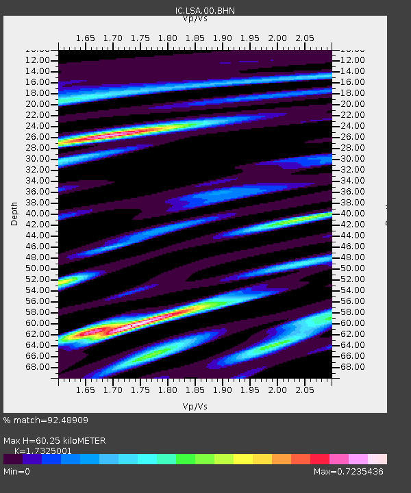
| Arrivals | |
| Ps | 7.1 SECOND |
| PpPs | 24 SECOND |
| PsPs/PpSs | 31 SECOND |

