You are here: Home > Network List > IC - New China Digital Seismograph Network Stations List
> Station LSA Tibet, China > Earthquake Result Viewer
LSA Tibet, China - Earthquake Result Viewer

| Earthquake location: |
Banda Sea |
| Earthquake latitude/longitude: |
-7.5/127.9 |
| Earthquake time(UTC): |
2008/06/06 (158) 13:42:48 GMT |
| Earthquake Depth: |
122 km |
| Earthquake Magnitude: |
5.7 MB, 6.0 MW, 6.0 MW |
| Earthquake Catalog/Contributor: |
WHDF/NEIC |
|
| Network: |
IC New China Digital Seismograph Network |
| Station: |
LSA Tibet, China |
| Lat/Lon: |
29.70 N/91.15 E |
| Elevation: |
3789 m |
|
| Distance: |
51.1 deg |
| Az: |
318.059 deg |
| Baz: |
130.385 deg |
| Ray Param: |
0.06720551 |
| Estimated Moho Depth: |
44.25 km |
| Estimated Crust Vp/Vs: |
1.68 |
| Assumed Crust Vp: |
6.514 km/s |
| Estimated Crust Vs: |
3.883 km/s |
| Estimated Crust Poisson's Ratio: |
0.22 |
|
| Radial Match: |
93.46045 % |
| Radial Bump: |
386 |
| Transverse Match: |
87.434814 % |
| Transverse Bump: |
400 |
| SOD ConfigId: |
2504 |
| Insert Time: |
2010-03-04 22:47:25.850 +0000 |
| GWidth: |
2.5 |
| Max Bumps: |
400 |
| Tol: |
0.001 |
|
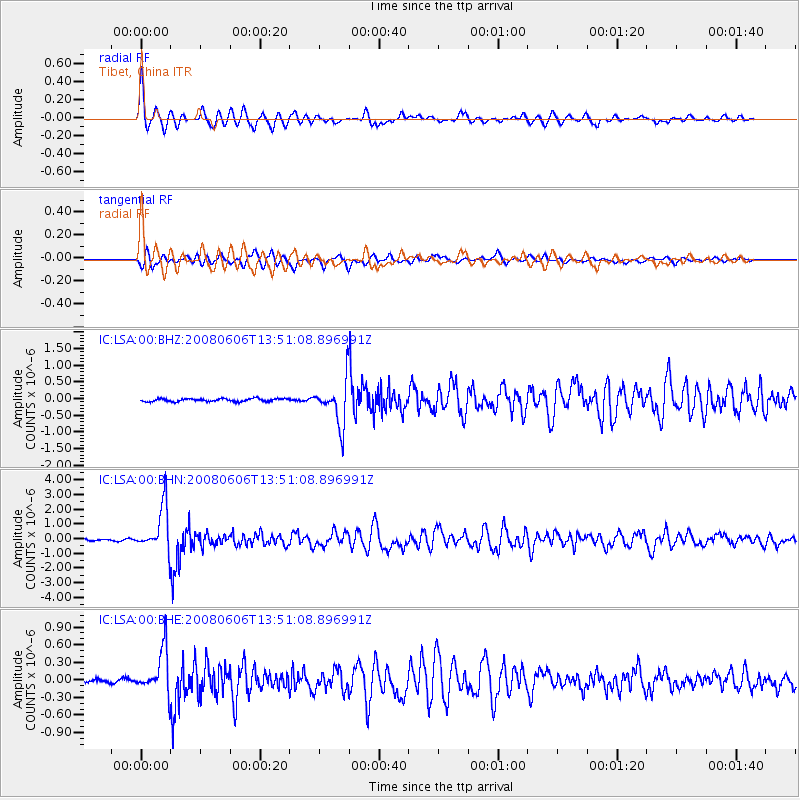
Signal To Noise
| Channel | StoN | STA | LTA |
| IC:LSA:00:BHN:20080606T13:51:08.896991Z | 24.165365 | 1.5318689E-6 | 6.339109E-8 |
| IC:LSA:00:BHE:20080606T13:51:08.896991Z | 17.874107 | 3.7439824E-7 | 2.0946402E-8 |
| IC:LSA:00:BHZ:20080606T13:51:08.896991Z | 14.135866 | 6.2132307E-7 | 4.395366E-8 |
| Arrivals |
| Ps | 4.9 SECOND |
| PpPs | 17 SECOND |
| PsPs/PpSs | 22 SECOND |


