You are here: Home > Network List > TA - USArray Transportable Network (new EarthScope stations) Stations List
> Station X43A Marvell, AR, USA > Earthquake Result Viewer
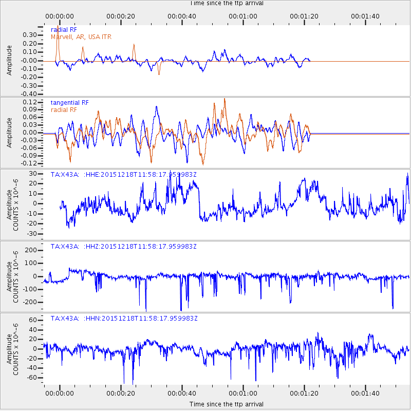
X43A Marvell, AR, USA - Earthquake Result Viewer
*The percent match for this event was below the threshold and hence no stack was calculated.
| Earthquake location: |
North Of Ascension Island |
| Earthquake latitude/longitude: |
-1.4/-15.8 |
| Earthquake time(UTC): |
2015/12/18 (352) 11:46:48 GMT |
| Earthquake Depth: |
10 km |
| Earthquake Magnitude: |
5.6 MB |
| Earthquake Catalog/Contributor: |
NEIC PDE/NEIC COMCAT |
|
| Network: |
TA USArray Transportable Network (new EarthScope stations) |
| Station: |
X43A Marvell, AR, USA |
| Lat/Lon: |
34.52 N/90.88 W |
| Elevation: |
53 m |
|
| Distance: |
78.5 deg |
| Az: |
305.494 deg |
| Baz: |
99.685 deg |
| Ray Param: |
$rayparam |
*The percent match for this event was below the threshold and hence was not used in the summary stack. |
|
| Radial Match: |
63.317245 % |
| Radial Bump: |
367 |
| Transverse Match: |
49.666206 % |
| Transverse Bump: |
387 |
| SOD ConfigId: |
7422571 |
| Insert Time: |
2019-04-21 14:50:39.159 +0000 |
| GWidth: |
2.5 |
| Max Bumps: |
400 |
| Tol: |
0.001 |
|
Signal To Noise
| Channel | StoN | STA | LTA |
| TA:X43A: :HHZ:20151218T11:58:17.959983Z | 2.2850158 | 3.678692E-5 | 1.6099197E-5 |
| TA:X43A: :HHN:20151218T11:58:17.959983Z | 0.47654787 | 5.835172E-6 | 1.2244672E-5 |
| TA:X43A: :HHE:20151218T11:58:17.959983Z | 1.5875231 | 1.0666077E-5 | 6.718691E-6 |
| Arrivals |
| Ps | |
| PpPs | |
| PsPs/PpSs | |


