
LSA Tibet, China - Earthquake Result Viewer
| ||||||||||||||||||
| ||||||||||||||||||
| ||||||||||||||||||
|
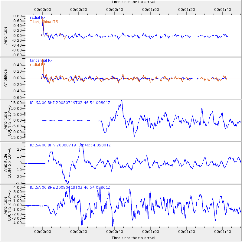
Signal To Noise
| Channel | StoN | STA | LTA |
| IC:LSA:00:BHN:20080719T02:46:54.09801Z | 82.62586 | 7.871883E-6 | 9.527142E-8 |
| IC:LSA:00:BHE:20080719T02:46:54.09801Z | 18.063066 | 7.338991E-7 | 4.0629818E-8 |
| IC:LSA:00:BHZ:20080719T02:46:54.09801Z | 75.89068 | 4.2539987E-6 | 5.6054297E-8 |
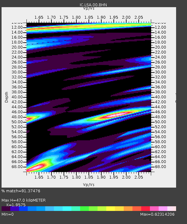
| Arrivals | |
| Ps | 7.4 SECOND |
| PpPs | 20 SECOND |
| PsPs/PpSs | 27 SECOND |

