You are here: Home > Network List > CI - Caltech Regional Seismic Network Stations List
> Station MPM Manuel Prospect Mine, California, USA > Earthquake Result Viewer
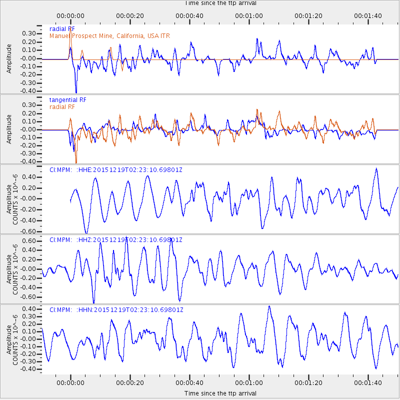
MPM Manuel Prospect Mine, California, USA - Earthquake Result Viewer
*The percent match for this event was below the threshold and hence no stack was calculated.
| Earthquake location: |
Vanuatu Islands |
| Earthquake latitude/longitude: |
-18.4/169.4 |
| Earthquake time(UTC): |
2015/12/19 (353) 02:10:53 GMT |
| Earthquake Depth: |
10 km |
| Earthquake Magnitude: |
6.2 MWP |
| Earthquake Catalog/Contributor: |
NEIC PDE/NEIC COMCAT |
|
| Network: |
CI Caltech Regional Seismic Network |
| Station: |
MPM Manuel Prospect Mine, California, USA |
| Lat/Lon: |
36.06 N/117.49 W |
| Elevation: |
185 m |
|
| Distance: |
87.7 deg |
| Az: |
50.892 deg |
| Baz: |
245.406 deg |
| Ray Param: |
$rayparam |
*The percent match for this event was below the threshold and hence was not used in the summary stack. |
|
| Radial Match: |
48.59889 % |
| Radial Bump: |
400 |
| Transverse Match: |
56.064034 % |
| Transverse Bump: |
400 |
| SOD ConfigId: |
7422571 |
| Insert Time: |
2019-04-21 14:54:30.521 +0000 |
| GWidth: |
2.5 |
| Max Bumps: |
400 |
| Tol: |
0.001 |
|
Signal To Noise
| Channel | StoN | STA | LTA |
| CI:MPM: :HHZ:20151219T02:23:10.69801Z | 2.2016728 | 2.2319449E-7 | 1.0137496E-7 |
| CI:MPM: :HHN:20151219T02:23:10.69801Z | 1.2713931 | 2.110074E-7 | 1.6596552E-7 |
| CI:MPM: :HHE:20151219T02:23:10.69801Z | 0.7616492 | 1.9188909E-7 | 2.5193893E-7 |
| Arrivals |
| Ps | |
| PpPs | |
| PsPs/PpSs | |


