LSA Tibet, China - Earthquake Result Viewer
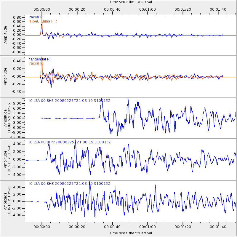
Earthquake location: Southern Sumatra, Indonesia
Earthquake latitude/longitude: -2.2/99.8
Earthquake time(UTC): 2008/02/25 (056) 21:02:18 GMT
Earthquake Depth: 25 km
Earthquake Magnitude: 6.2 MB, 6.6 MS, 6.6 MW, 6.5 MW
Earthquake Catalog/Contributor: WHDF/NEIC
Network: IC New China Digital Seismograph Network
Station: LSA Tibet, China
Lat/Lon: 29.70 N/91.15 E
Elevation: 3789 m
Distance: 32.8 deg
Az: 346.019 deg
Baz: 163.89 deg
Ray Param: 0.078455195
Estimated Moho Depth: 35.25 km
Estimated Crust Vp/Vs: 1.92
Assumed Crust Vp: 6.514 km/s
Estimated Crust Vs: 3.393 km/s
Estimated Crust Poisson's Ratio: 0.31
Radial Match: 91.50987 %
Radial Bump: 400
Transverse Match: 84.604675 %
Transverse Bump: 400
SOD ConfigId: 2564
Insert Time: 2010-03-04 22:48:21.825 +0000
GWidth: 2.5
Max Bumps: 400
Tol: 0.001

Signal To Noise

ChannelStoNSTALTA
IC:LSA:00:BHN:20080225T21:08:19.310015Z65.057611.7669518E-62.7159803E-8
IC:LSA:00:BHE:20080225T21:08:19.310015Z11.8048159.0753815E-77.687864E-8
IC:LSA:00:BHZ:20080225T21:08:19.310015Z33.8555155.1154657E-61.5109697E-7
Arrivals
Ps5.4 SECOND
PpPs15 SECOND
PsPs/PpSs20 SECOND