You are here: Home > Network List > CI - Caltech Regional Seismic Network Stations List
> Station VES Vestal, Porterville, CA, USA > Earthquake Result Viewer
VES Vestal, Porterville, CA, USA - Earthquake Result Viewer

| Earthquake location: |
Fiji Islands Region |
| Earthquake latitude/longitude: |
-15.3/-178.6 |
| Earthquake time(UTC): |
2005/12/13 (347) 03:16:06 GMT |
| Earthquake Depth: |
10 km |
| Earthquake Magnitude: |
6.1 MB, 6.8 MS, 6.7 MW, 6.7 MW |
| Earthquake Catalog/Contributor: |
WHDF/NEIC |
|
| Network: |
CI Caltech Regional Seismic Network |
| Station: |
VES Vestal, Porterville, CA, USA |
| Lat/Lon: |
35.84 N/119.08 W |
| Elevation: |
154 m |
|
| Distance: |
75.8 deg |
| Az: |
46.229 deg |
| Baz: |
239.068 deg |
| Ray Param: |
0.051438153 |
| Estimated Moho Depth: |
13.0 km |
| Estimated Crust Vp/Vs: |
1.74 |
| Assumed Crust Vp: |
6.1 km/s |
| Estimated Crust Vs: |
3.501 km/s |
| Estimated Crust Poisson's Ratio: |
0.25 |
|
| Radial Match: |
95.37619 % |
| Radial Bump: |
361 |
| Transverse Match: |
92.23381 % |
| Transverse Bump: |
347 |
| SOD ConfigId: |
2422 |
| Insert Time: |
2010-02-26 00:01:38.579 +0000 |
| GWidth: |
2.5 |
| Max Bumps: |
400 |
| Tol: |
0.001 |
|
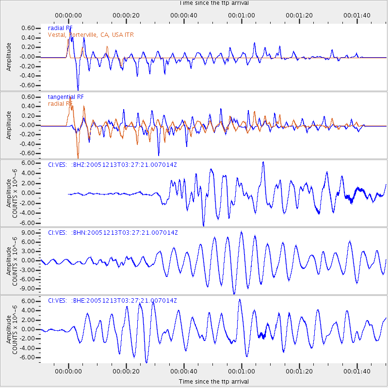
Signal To Noise
| Channel | StoN | STA | LTA |
| CI:VES: :BHN:20051213T03:27:21.007014Z | 1.0935534 | 4.970259E-7 | 4.545054E-7 |
| CI:VES: :BHE:20051213T03:27:21.007014Z | 3.1989312 | 1.2746905E-6 | 3.9847387E-7 |
| CI:VES: :BHZ:20051213T03:27:21.007014Z | 9.3242235 | 1.1970554E-6 | 1.2838125E-7 |
| Arrivals |
| Ps | 1.6 SECOND |
| PpPs | 5.7 SECOND |
| PsPs/PpSs | 7.3 SECOND |


