You are here: Home > Network List > TA - USArray Transportable Network (new EarthScope stations) Stations List
> Station 121A Cookes Peak, Deming, NM, USA > Earthquake Result Viewer
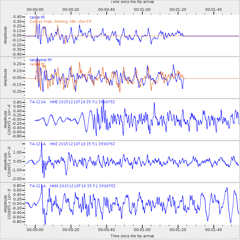
121A Cookes Peak, Deming, NM, USA - Earthquake Result Viewer
*The percent match for this event was below the threshold and hence no stack was calculated.
| Earthquake location: |
Near Coast Of Central Chile |
| Earthquake latitude/longitude: |
-30.6/-71.4 |
| Earthquake time(UTC): |
2015/12/19 (353) 19:25:04 GMT |
| Earthquake Depth: |
46 km |
| Earthquake Magnitude: |
5.8 MWR |
| Earthquake Catalog/Contributor: |
NEIC PDE/NEIC COMCAT |
|
| Network: |
TA USArray Transportable Network (new EarthScope stations) |
| Station: |
121A Cookes Peak, Deming, NM, USA |
| Lat/Lon: |
32.53 N/107.79 W |
| Elevation: |
1652 m |
|
| Distance: |
71.7 deg |
| Az: |
328.112 deg |
| Baz: |
147.387 deg |
| Ray Param: |
$rayparam |
*The percent match for this event was below the threshold and hence was not used in the summary stack. |
|
| Radial Match: |
55.367416 % |
| Radial Bump: |
400 |
| Transverse Match: |
64.03227 % |
| Transverse Bump: |
400 |
| SOD ConfigId: |
7422571 |
| Insert Time: |
2019-04-21 15:09:04.274 +0000 |
| GWidth: |
2.5 |
| Max Bumps: |
400 |
| Tol: |
0.001 |
|
Signal To Noise
| Channel | StoN | STA | LTA |
| TA:121A: :HHZ:20151219T19:35:51.369976Z | 3.8798811 | 7.064093E-7 | 1.8206983E-7 |
| TA:121A: :HHN:20151219T19:35:51.369976Z | 1.3761079 | 3.1427234E-7 | 2.2837769E-7 |
| TA:121A: :HHE:20151219T19:35:51.369976Z | 3.173783 | 3.5260624E-7 | 1.11099666E-7 |
| Arrivals |
| Ps | |
| PpPs | |
| PsPs/PpSs | |


