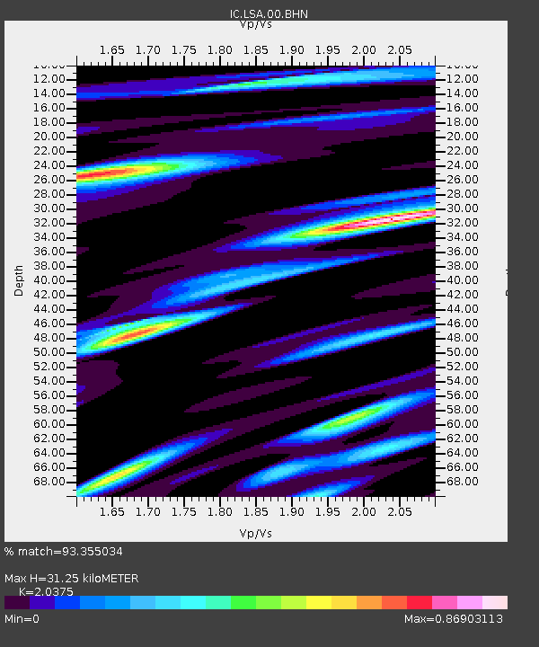
LSA Tibet, China - Earthquake Result Viewer
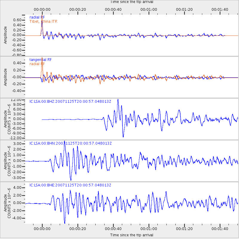
Earthquake location: Sumbawa Region, Indonesia
Earthquake latitude/longitude: -8.2/118.5
Earthquake time(UTC): 2007/11/25 (329) 19:53:07 GMT
Earthquake Depth: 35 km
Earthquake Magnitude: 6.2 MB, 6.2 MS, 6.5 MW, 6.4 MW
Earthquake Catalog/Contributor: WHDF/NEIC
Network: IC New China Digital Seismograph Network
Station: LSA Tibet, China
Lat/Lon: 29.70 N/91.15 E
Elevation: 3789 m
Distance: 46.0 deg
Az: 326.274 deg
Baz: 140.827 deg
Ray Param: 0.07087432
Estimated Moho Depth: 31.25 km
Estimated Crust Vp/Vs: 2.04
Assumed Crust Vp: 6.514 km/s
Estimated Crust Vs: 3.197 km/s
Estimated Crust Poisson's Ratio: 0.34
Radial Match: 93.355034 %
Radial Bump: 385
Transverse Match: 86.57293 %
Transverse Bump: 400
SOD ConfigId: 2564
Insert Time: 2010-03-04 22:50:04.115 +0000
GWidth: 2.5
Max Bumps: 400
Tol: 0.001

Signal To Noise

ChannelStoNSTALTA
IC:LSA:00:BHN:20071125T20:00:57.048013Z4.1806831.18695326E-72.8391371E-8
IC:LSA:00:BHE:20071125T20:00:57.048013Z1.64859631.1334059E-76.8749756E-8
IC:LSA:00:BHZ:20071125T20:00:57.048013Z4.39975173.8018416E-78.641037E-8
Arrivals
Ps5.3 SECOND
PpPs14 SECOND
PsPs/PpSs19 SECOND