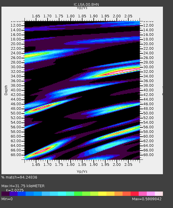
LSA Tibet, China - Earthquake Result Viewer
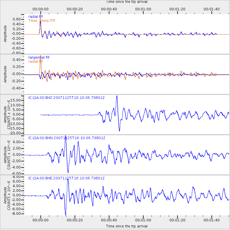
Earthquake location: Sumbawa Region, Indonesia
Earthquake latitude/longitude: -8.3/118.3
Earthquake time(UTC): 2007/11/25 (329) 16:02:17 GMT
Earthquake Depth: 35 km
Earthquake Magnitude: 6.2 MB, 6.3 MS, 6.5 MW, 6.4 MW
Earthquake Catalog/Contributor: WHDF/NEIC
Network: IC New China Digital Seismograph Network
Station: LSA Tibet, China
Lat/Lon: 29.70 N/91.15 E
Elevation: 3789 m
Distance: 45.9 deg
Az: 326.409 deg
Baz: 140.997 deg
Ray Param: 0.07088641
Estimated Moho Depth: 31.75 km
Estimated Crust Vp/Vs: 2.02
Assumed Crust Vp: 6.514 km/s
Estimated Crust Vs: 3.221 km/s
Estimated Crust Poisson's Ratio: 0.34
Radial Match: 94.24836 %
Radial Bump: 400
Transverse Match: 91.06144 %
Transverse Bump: 400
SOD ConfigId: 2564
Insert Time: 2010-03-04 22:50:06.822 +0000
GWidth: 2.5
Max Bumps: 400
Tol: 0.001

Signal To Noise

ChannelStoNSTALTA
IC:LSA:00:BHN:20071125T16:10:06.79801Z12.1490732.870411E-72.3626587E-8
IC:LSA:00:BHE:20071125T16:10:06.79801Z5.5741583.43044E-76.1541854E-8
IC:LSA:00:BHZ:20071125T16:10:06.79801Z23.1687581.0013877E-64.3221462E-8
Arrivals
Ps5.3 SECOND
PpPs14 SECOND
PsPs/PpSs19 SECOND