
LSA Tibet, China - Earthquake Result Viewer
| ||||||||||||||||||
| ||||||||||||||||||
| ||||||||||||||||||
|
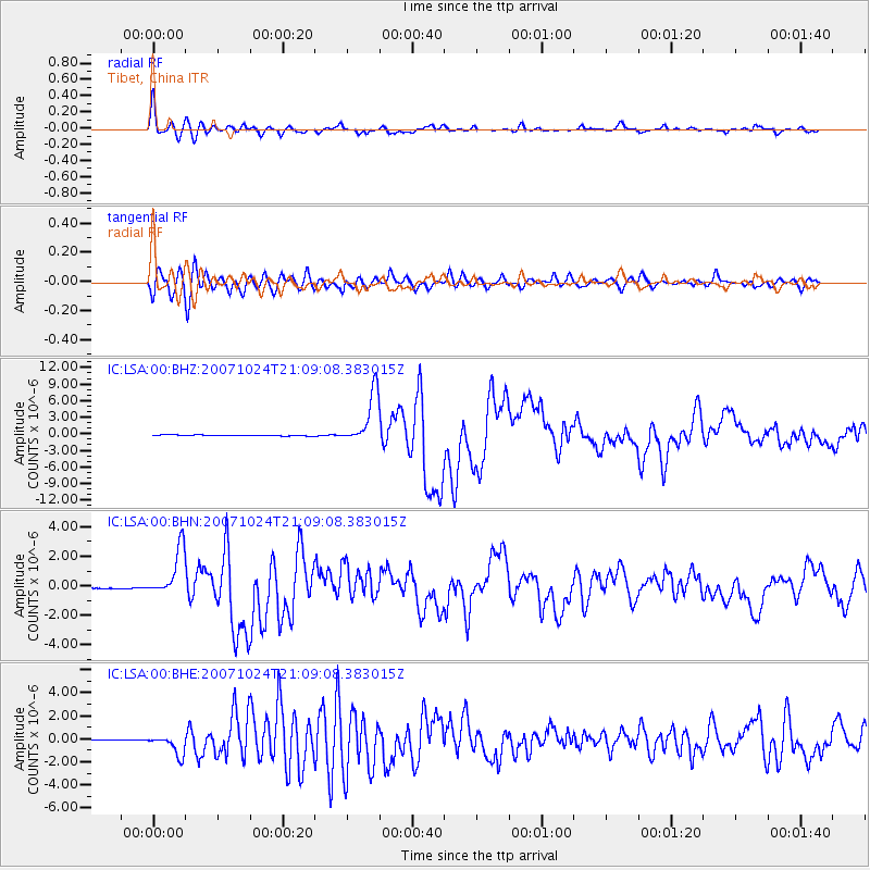
Signal To Noise
| Channel | StoN | STA | LTA |
| IC:LSA:00:BHN:20071024T21:09:08.383015Z | 41.615746 | 1.6435206E-6 | 3.9492758E-8 |
| IC:LSA:00:BHE:20071024T21:09:08.383015Z | 24.238953 | 8.6831983E-7 | 3.5823323E-8 |
| IC:LSA:00:BHZ:20071024T21:09:08.383015Z | 56.026997 | 4.7131484E-6 | 8.412281E-8 |
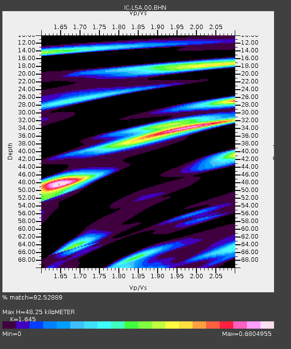
| Arrivals | |
| Ps | 5.2 SECOND |
| PpPs | 18 SECOND |
| PsPs/PpSs | 23 SECOND |

