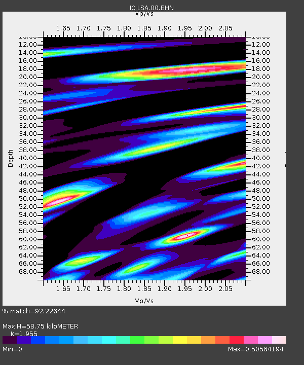
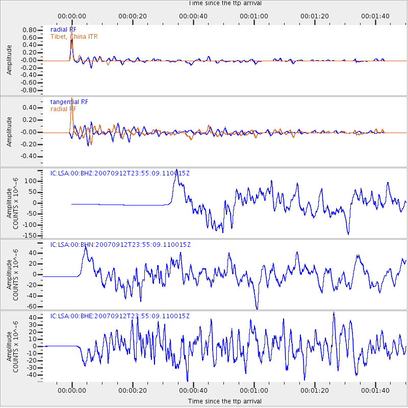
LSA Tibet, China - Earthquake Result Viewer

Earthquake location: Southern Sumatra, Indonesia
Earthquake latitude/longitude: -2.6/100.8
Earthquake time(UTC): 2007/09/12 (255) 23:49:03 GMT
Earthquake Depth: 35 km
Earthquake Magnitude: 6.6 MB, 8.1 MS, 7.9 MW, 7.6 ME
Earthquake Catalog/Contributor: WHDF/NEIC
Network: IC New China Digital Seismograph Network
Station: LSA Tibet, China
Lat/Lon: 29.70 N/91.15 E
Elevation: 3789 m
Distance: 33.5 deg
Az: 344.593 deg
Baz: 162.239 deg
Ray Param: 0.078141995
Estimated Moho Depth: 58.75 km
Estimated Crust Vp/Vs: 1.96
Assumed Crust Vp: 6.514 km/s
Estimated Crust Vs: 3.332 km/s
Estimated Crust Poisson's Ratio: 0.32
Radial Match: 92.22644 %
Radial Bump: 400
Transverse Match: 84.03263 %
Transverse Bump: 400
SOD ConfigId: 2564
Insert Time: 2010-03-04 22:50:46.228 +0000
GWidth: 2.5
Max Bumps: 400
Tol: 0.001

Signal To Noise

ChannelStoNSTALTA
IC:LSA:00:BHN:20070912T23:55:09.110015Z24.270552.3007131E-59.4794433E-7
IC:LSA:00:BHE:20070912T23:55:09.110015Z24.5962681.1724757E-54.7668846E-7
IC:LSA:00:BHZ:20070912T23:55:09.110015Z38.9930576.7387155E-51.7281834E-6
Arrivals
Ps9.3 SECOND
PpPs25 SECOND
PsPs/PpSs34 SECOND