You are here: Home > Network List > CI - Caltech Regional Seismic Network Stations List
> Station VES Vestal, Richgrove, CA, USA > Earthquake Result Viewer
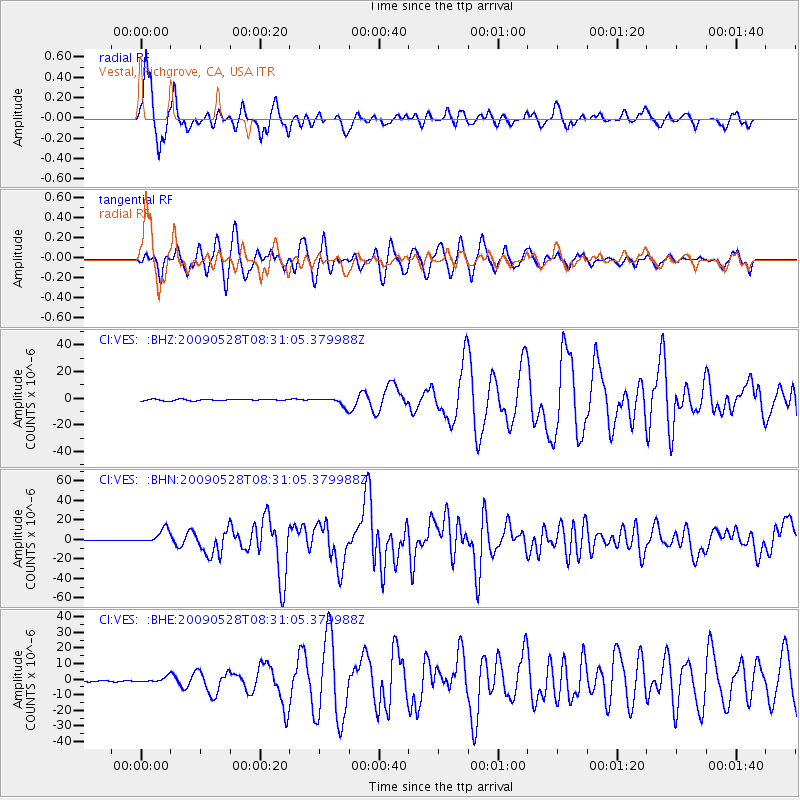
VES Vestal, Richgrove, CA, USA - Earthquake Result Viewer

| Earthquake location: |
North Of Honduras |
| Earthquake latitude/longitude: |
16.7/-86.2 |
| Earthquake time(UTC): |
2009/05/28 (148) 08:24:45 GMT |
| Earthquake Depth: |
10 km |
| Earthquake Magnitude: |
6.7 MB, 7.2 MS, 7.3 MW, 7.3 MW |
| Earthquake Catalog/Contributor: |
WHDF/NEIC |
|
| Network: |
CI Caltech Regional Seismic Network |
| Station: |
VES Vestal, Richgrove, CA, USA |
| Lat/Lon: |
35.84 N/119.08 W |
| Elevation: |
154 m |
|
| Distance: |
34.8 deg |
| Az: |
309.509 deg |
| Baz: |
114.506 deg |
| Ray Param: |
0.07753401 |
| Estimated Moho Depth: |
31.0 km |
| Estimated Crust Vp/Vs: |
2.06 |
| Assumed Crust Vp: |
6.1 km/s |
| Estimated Crust Vs: |
2.965 km/s |
| Estimated Crust Poisson's Ratio: |
0.35 |
|
| Radial Match: |
92.775314 % |
| Radial Bump: |
398 |
| Transverse Match: |
84.08395 % |
| Transverse Bump: |
400 |
| SOD ConfigId: |
2648 |
| Insert Time: |
2010-02-26 00:01:50.088 +0000 |
| GWidth: |
2.5 |
| Max Bumps: |
400 |
| Tol: |
0.001 |
|
Signal To Noise
| Channel | StoN | STA | LTA |
| CI:VES: :BHN:20090528T08:31:05.379988Z | 35.138786 | 7.3299375E-6 | 2.0859962E-7 |
| CI:VES: :BHE:20090528T08:31:05.379988Z | 3.3558729 | 1.7732101E-6 | 5.2839016E-7 |
| CI:VES: :BHZ:20090528T08:31:05.379988Z | 6.0779867 | 3.260629E-6 | 5.364653E-7 |
| Arrivals |
| Ps | 5.7 SECOND |
| PpPs | 15 SECOND |
| PsPs/PpSs | 20 SECOND |


