You are here: Home > Network List > TA - USArray Transportable Network (new EarthScope stations) Stations List
> Station J01E Myrtle Point, OR, USA > Earthquake Result Viewer
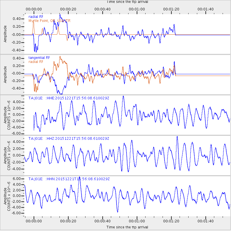
J01E Myrtle Point, OR, USA - Earthquake Result Viewer
*The percent match for this event was below the threshold and hence no stack was calculated.
| Earthquake location: |
New Britain Region, P.N.G. |
| Earthquake latitude/longitude: |
-4.4/152.0 |
| Earthquake time(UTC): |
2015/12/21 (355) 15:44:04 GMT |
| Earthquake Depth: |
162 km |
| Earthquake Magnitude: |
5.7 mwb |
| Earthquake Catalog/Contributor: |
NEIC PDE/us |
|
| Network: |
TA USArray Transportable Network (new EarthScope stations) |
| Station: |
J01E Myrtle Point, OR, USA |
| Lat/Lon: |
43.16 N/123.93 W |
| Elevation: |
128 m |
|
| Distance: |
88.7 deg |
| Az: |
46.72 deg |
| Baz: |
262.749 deg |
| Ray Param: |
$rayparam |
*The percent match for this event was below the threshold and hence was not used in the summary stack. |
|
| Radial Match: |
39.75072 % |
| Radial Bump: |
400 |
| Transverse Match: |
26.691301 % |
| Transverse Bump: |
400 |
| SOD ConfigId: |
7422571 |
| Insert Time: |
2019-04-21 15:20:43.464 +0000 |
| GWidth: |
2.5 |
| Max Bumps: |
400 |
| Tol: |
0.001 |
|
Signal To Noise
| Channel | StoN | STA | LTA |
| TA:J01E: :HHZ:20151221T15:56:08.610029Z | 0.69253844 | 1.4945716E-6 | 2.1581063E-6 |
| TA:J01E: :HHN:20151221T15:56:08.610029Z | 0.65672386 | 1.8325308E-6 | 2.7904127E-6 |
| TA:J01E: :HHE:20151221T15:56:08.610029Z | 1.0303586 | 2.3266E-6 | 2.2580489E-6 |
| Arrivals |
| Ps | |
| PpPs | |
| PsPs/PpSs | |


