You are here: Home > Network List > UW - Pacific Northwest Regional Seismic Network Stations List
> Station PASS Maple Falls, WA, USA > Earthquake Result Viewer
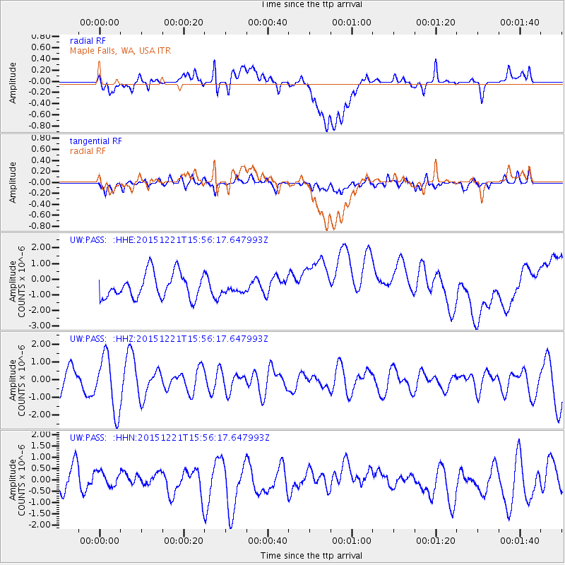
PASS Maple Falls, WA, USA - Earthquake Result Viewer
*The percent match for this event was below the threshold and hence no stack was calculated.
| Earthquake location: |
New Britain Region, P.N.G. |
| Earthquake latitude/longitude: |
-4.4/152.0 |
| Earthquake time(UTC): |
2015/12/21 (355) 15:44:04 GMT |
| Earthquake Depth: |
162 km |
| Earthquake Magnitude: |
5.7 mwb |
| Earthquake Catalog/Contributor: |
NEIC PDE/us |
|
| Network: |
UW Pacific Northwest Regional Seismic Network |
| Station: |
PASS Maple Falls, WA, USA |
| Lat/Lon: |
49.00 N/122.09 W |
| Elevation: |
174 m |
|
| Distance: |
90.6 deg |
| Az: |
41.07 deg |
| Baz: |
264.044 deg |
| Ray Param: |
$rayparam |
*The percent match for this event was below the threshold and hence was not used in the summary stack. |
|
| Radial Match: |
19.243263 % |
| Radial Bump: |
400 |
| Transverse Match: |
35.293327 % |
| Transverse Bump: |
400 |
| SOD ConfigId: |
7422571 |
| Insert Time: |
2019-04-21 15:21:17.174 +0000 |
| GWidth: |
2.5 |
| Max Bumps: |
400 |
| Tol: |
0.001 |
|
Signal To Noise
| Channel | StoN | STA | LTA |
| UW:PASS: :HHZ:20151221T15:56:17.647993Z | 3.3761475 | 1.5999753E-6 | 4.7390566E-7 |
| UW:PASS: :HHN:20151221T15:56:17.647993Z | 0.4253138 | 3.0334175E-7 | 7.132187E-7 |
| UW:PASS: :HHE:20151221T15:56:17.647993Z | 0.3690385 | 2.9120923E-7 | 7.8910256E-7 |
| Arrivals |
| Ps | |
| PpPs | |
| PsPs/PpSs | |


