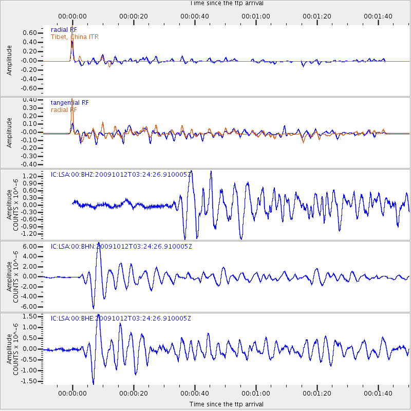
LSA Tibet, China - Earthquake Result Viewer
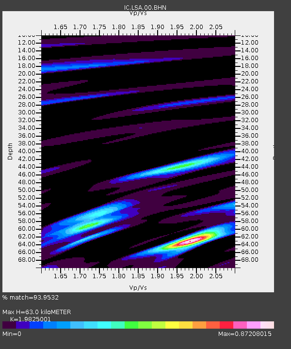
Earthquake location: Mauritius - Reunion Region
Earthquake latitude/longitude: -17.1/66.7
Earthquake time(UTC): 2009/10/12 (285) 03:15:47 GMT
Earthquake Depth: 10 km
Earthquake Magnitude: 6.2 MB, 6.0 MS, 6.2 MW, 6.1 MW
Earthquake Catalog/Contributor: WHDF/NEIC
Network: IC New China Digital Seismograph Network
Station: LSA Tibet, China
Lat/Lon: 29.70 N/91.15 E
Elevation: 3789 m
Distance: 52.2 deg
Az: 27.139 deg
Baz: 210.093 deg
Ray Param: 0.06693167
Estimated Moho Depth: 63.0 km
Estimated Crust Vp/Vs: 1.98
Assumed Crust Vp: 6.514 km/s
Estimated Crust Vs: 3.286 km/s
Estimated Crust Poisson's Ratio: 0.33
Radial Match: 93.9532 %
Radial Bump: 400
Transverse Match: 85.69199 %
Transverse Bump: 400
SOD ConfigId: 2622
Insert Time: 2010-03-04 22:51:42.129 +0000
GWidth: 2.5
Max Bumps: 400
Tol: 0.001

Signal To Noise

ChannelStoNSTALTA
IC:LSA:00:BHN:20091012T03:24:26.910005Z7.8209294.4974132E-75.7504845E-8
IC:LSA:00:BHE:20091012T03:24:26.910005Z3.8925081.1242751E-72.888305E-8
IC:LSA:00:BHZ:20091012T03:24:26.910005Z1.06723399.010237E-88.442607E-8
Arrivals
Ps10 SECOND
PpPs27 SECOND
PsPs/PpSs37 SECOND