You are here: Home > Network List > TA - USArray Transportable Network (new EarthScope stations) Stations List
> Station X43A Marvell, AR, USA > Earthquake Result Viewer
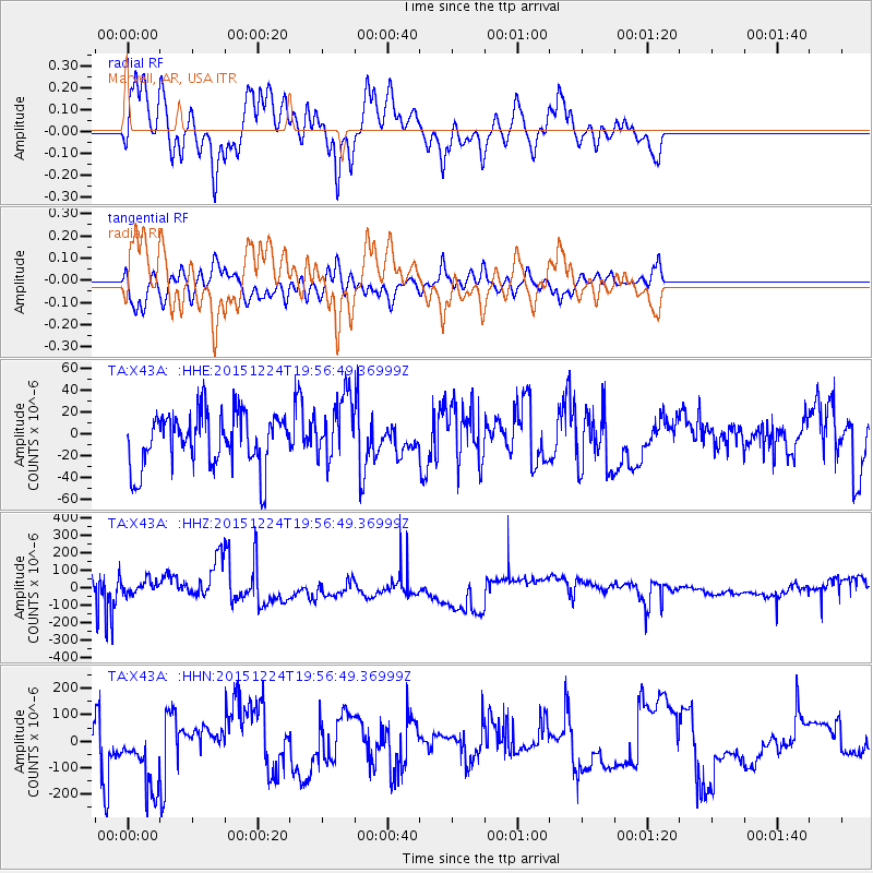
X43A Marvell, AR, USA - Earthquake Result Viewer
*The percent match for this event was below the threshold and hence no stack was calculated.
| Earthquake location: |
Southern East Pacific Rise |
| Earthquake latitude/longitude: |
-55.8/-123.1 |
| Earthquake time(UTC): |
2015/12/24 (358) 19:44:03 GMT |
| Earthquake Depth: |
12 km |
| Earthquake Magnitude: |
6.2 MWW, 6.1 MWB, 6.2 MWC |
| Earthquake Catalog/Contributor: |
NEIC PDE/NEIC COMCAT |
|
| Network: |
TA USArray Transportable Network (new EarthScope stations) |
| Station: |
X43A Marvell, AR, USA |
| Lat/Lon: |
34.52 N/90.88 W |
| Elevation: |
53 m |
|
| Distance: |
94.0 deg |
| Az: |
26.201 deg |
| Baz: |
197.595 deg |
| Ray Param: |
$rayparam |
*The percent match for this event was below the threshold and hence was not used in the summary stack. |
|
| Radial Match: |
55.251225 % |
| Radial Bump: |
365 |
| Transverse Match: |
50.192146 % |
| Transverse Bump: |
400 |
| SOD ConfigId: |
7422571 |
| Insert Time: |
2019-04-21 15:29:40.860 +0000 |
| GWidth: |
2.5 |
| Max Bumps: |
400 |
| Tol: |
0.001 |
|
Signal To Noise
| Channel | StoN | STA | LTA |
| TA:X43A: :HHZ:20151224T19:56:49.36999Z | 0.33287668 | 4.3988308E-5 | 1.3214596E-4 |
| TA:X43A: :HHN:20151224T19:56:49.36999Z | 1.2790438 | 1.4174638E-4 | 1.10822155E-4 |
| TA:X43A: :HHE:20151224T19:56:49.36999Z | 1.199448 | 2.9186369E-5 | 2.4333167E-5 |
| Arrivals |
| Ps | |
| PpPs | |
| PsPs/PpSs | |


